THURSDAY, SEPTEMBER 17, 2020 AS OF 9:00 AM EDT
Hurricane Sally made landfall at 5:45 AM on Wednesday September 16 as a Category 2 hurricane near Gulf Shores, Alabama, according to the National Oceanic and Atmospheric Administration (NOAA) National Hurricane Center (NHC). At the time, Hurricane Sally sustained wind speeds of 105 miles per hour (mph). At this time, reports indicate that Sally is directly responsible for one fatality. Since making landfall, Sally has decreased speed and is currently a Tropical Depression moving northeast across southern Alabama at 12 mph, with wind speeds of 30 mph. Sally is expected to continue moving east-northeastward along the East Coast bringing historical levels of rainfall and major river flooding before the system moves back out to sea.
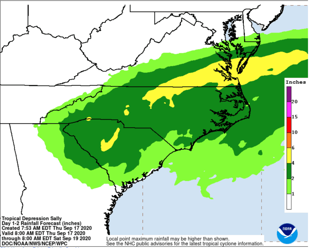
NOAA: U.S. Rainfall Forecast – Tropical Depression Sally
While Tropical Depression Sally continues to wreak havoc across the Gulf Coast, other disturbances continue to develop in the Atlantic Ocean. There are currently five active systems in the Atlantic — one hurricane, one tropical storm, and three disturbances with the potential to become storms in the next five days.
The NHC reports that Hurricane Teddy is strengthening over the open Atlantic and projected to become a major hurricane by Friday. It is approximately 625 miles east-northeast from the Lesser Antilles, moving northwest at 12 mph, with maximum sustained winds of 105 mph. According to the NHC, Vicky is currently situated in the heart of the Atlantic Ocean, moving toward the west-northwest near 7 mph. With current wind speeds of 40 mph and increasing, Vicky is expected to strengthen to a Tropical Depression later today, and continue to move west-southwest into Friday. As numerous disturbances continue to move towards land, residents of the United States (US) can expect increased thunderstorm activity and/or heavy rainfall in the next week.
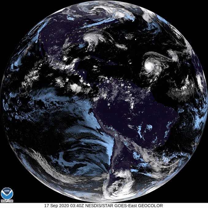
NOAA: GOES Image Viewer
The California Department of Forestry and Fire Protection (CAL FIRE) reports that, to-date, wildfires across the state have burned 3.15 million acres of land. At present, the largest active incident in California is the August Complex (including the Doe Fire), which has consumed 796,651 acres and is 30 percent contained. CAL FIRE issued a Fire Weather Watch across the eastern Sierra in California; from Modoc County to Inyo County, bringing critical fire weather conditions to the area.
The State of Oregon Fires and Hotspots Dashboard reports 26 active fires in the state, with 940,950 acres burned to-date. The largest incident in Oregon is the Beachie Creek wildfire, which has burned 190,137 acres and is 20 percent contained. It has resulted in four fatalities and three injuries, in addition to destroying 470 residences and 818 other structures.
Air quality is still unhealthy in some areas impacted by statewide wildfires. For the latest air quality info, visit https://t.co/P4Tv0l7iLO #creekfire pic.twitter.com/rhimIrDGRu
— Cal OES (@Cal_OES) September 16, 2020
Twitter: CAL OES
Smoke from the dozens of wildfires spreading across California and the western US has dispersed across the country and into Mexico, Canada, and Europe, according to AP News. The European Union’s Copernicus Atmosphere Monitoring Service observed smoke from the fires spreading almost 5,000 miles to Britain and other areas of northern Europe. The European Centre for Medium-Range Weather Forecasts also observed that the fires in Oregon, Washington, and California have released approximately 33.4 million tons of carbon. AirNow.gov issued smoke advisories for 12 states and British Columbia, Canada; cautioning unhealthy to hazardous air quality.
 The Ready Campaign: Source
NOAA provides information on Storm Surge Warnings and Storm Surge Watch. If you are under a warning or watch, make sure to seek higher ground. Storm surge can pose a life-threatening danger from rising water filled with debris.
Additionally, FEMA provides guidance to individuals preparing for, experiencing, or affected by hurricanes. Tropical Depression Sally brings the potential for life-threatening storm surge to many coastal communities. Individuals should heed the warnings of local authorities and prepare for hurricane and severe weather conditions.
PUBLIC ADVISORIES
To get a breakdown by State and County of public advisories from NOAA’s NWS in decreasing order of severity, click here.
RELATED STORIES
- Remember, Ready.gov provides information on how to prepare for Wildfire and how to keep you and your family safe.
- The Los Angeles Times regularly updated tracking of California Wildfires: California Wildfires Map.
- The National Fire Protection Association provides wildfire preparedness tips: link
- Marin County provides a wildfire evacuation checklist: link
- FEMA provides an information video about how to be prepared for Wildfires: link
- Understanding the meaning of hurricane maps – a NY Times Opinion Piece: Those Hurricane Maps Don’t Mean What You Think They Mean