WEDNESDAY, JULY 29, 2020 AS OF 6:15 PM EST
The National Oceanic and Atmospheric Administration (NOAA) National Hurricane Center (NHC) has issued advisories on Potential Tropical Cyclone Nine, with a high chance of formation (90 percent) in the next 48 hours. It is currently located near the Leeward Islands, moving west-northwest at approximately 23 mph with maximum sustained winds near 45 mph.The NHC stressed the low confidence of the forecast in the near and long term due to the absence of a well-defined center, but cautioned tropical storm conditions were likely across sections of the Leeward Islands, the Virgin Islands, and Puerto Rico on Wednesday, July 29. Potential Tropical Cyclone Nine could bring heavy rain, mud slides, and potentially deadly flash floods across the Northern Leeward Islands, the Virgin Islands, Puerto Rico, and the Dominican Republic. Heavy, tropical rain is expected throughout Thursday from the Leeward Islands to Puerto Rico and Hispaniola. While the impact to the mainland United States (US) is still uncertain, the current cone and trajectory shows potential landfall in Florida on Sunday, August 2. Hagerty will be monitoring the development of the storm closely over the next 48 hours for potential impacts in both Puerto Rico and Florida.
Hurricane Douglas is currently moving with maximum sustained winds of 35 mph in the Pacific Ocean, 420 miles west-northwest of Kahului, according to the NHC. Douglas was downgraded to a post-tropical cyclone. The NHC lifted the hurricane warning for Hawaii. Douglas made history by moving closer to Oahu in Hawaii than any other hurricane on record, according to the Hawaii News Now.
#Douglas has become post-tropical as it approaches the International Date Line. Douglas was a named storm for over 8 days and also generated the most Accumulated Cyclone Energy of any Northern Hemisphere 2020 tropical cyclone to date. pic.twitter.com/qMDaZb9DWw
— Philip Klotzbach (@philklotzbach) July 29, 2020
Satellite image of Hurricane Douglas: Twitter
Since Tropical Storm Hanna made landfall on Padre Island on Saturday, July 25, the storm has drastically weakened. The NHC now classifies Hanna as a tropical depression. Hanna is currently moving west-southwest across northeastern Mexico at 9 mph, with maximum sustained winds of 35 mph. The NHC issued flash flooding and mudslide warnings for the Northern Mexican states of Coahuila, Nuevo Leon, and Tamaulipas.
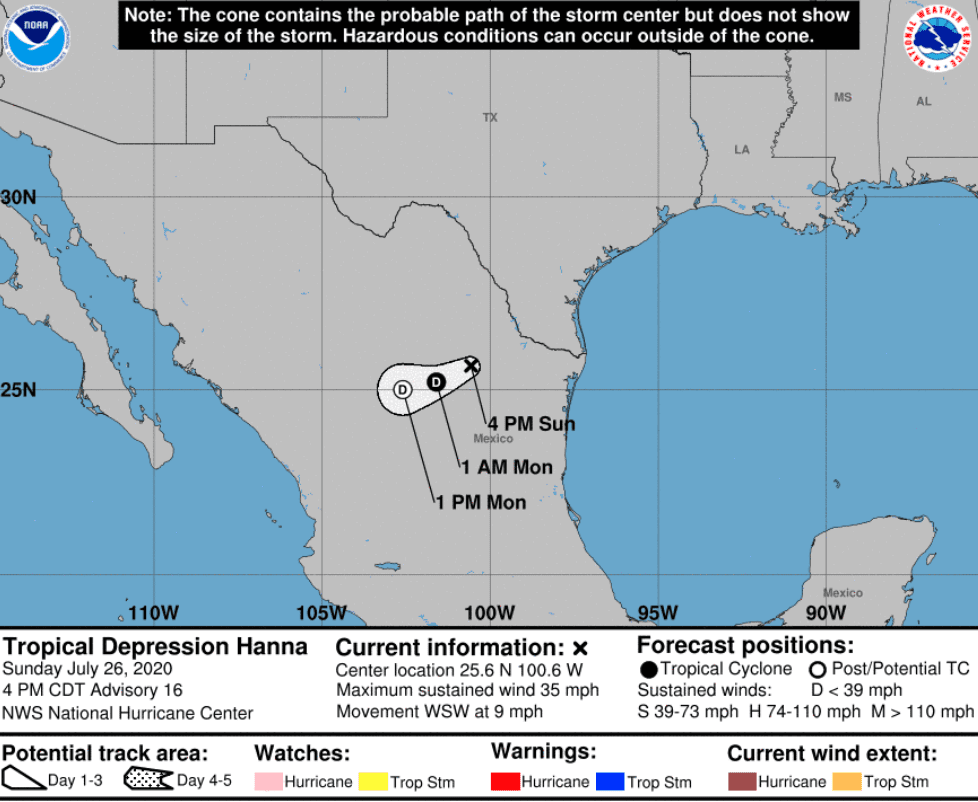
Movement of Tropical Depression Hanna: NHC
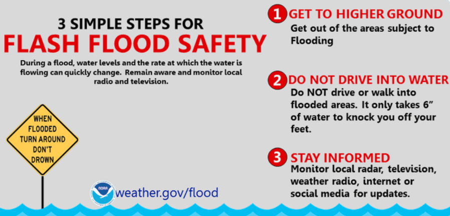
FEMA Flood Safety: Source
The Federal Emergency Management Agency (FEMA) encourages individuals to take the necessary precautions and prepare for flash flooding. Flash floods can develop with little to no warning, quickly changing the surrounding area. FEMA suggested individuals seek higher ground, avoid walking or driving in flood waters, and heed the warnings of local authorities. The Hagerty Blog Team will continue providing relevant disaster and incident coverage throughout the 2020 Hurricane Season.
PUBLIC ADVISORIES
Here’s the breakdown of public advisories from NOAA’s NHC:
TROPICAL STORM WARNING:
RELATED STORIES
- Remember, Ready.gov provides information on how to prepare for a storm and how to keep you and your family safe.
- Understanding the meaning of hurricane maps – a NY Times Opinion Piece: Those Hurricane Maps Don’t Mean What You Think They Mean
Keep track of Hagerty’s coverage here:
HURRICANE SEASON 2020