Beginning on Monday, February 26, multiple regions across the country have been affected by extreme weather and ongoing wildfires, causing significant impacts to communities from the West Coast to the Southern United States (US). From Thursday, February 29, to Monday, March 4, communities across Northern California and Oregon were significantly impacted by an intense blizzard that brought more than seven feet of snowfall to the region and trapped hundreds of motorists in their vehicles on I-80. Additionally, according to the Federal Emergency Management Agency’s (FEMA) Geospatial Resource Center (GIS), there are currently 21 active wildfires burning more than 1.29 million acres across Minnesota, New Mexico, Oklahoma, and Texas. The majority of wildfire activity has impacted the State of Texas, causing multiple fatalities, severe structural damage, and mass cattle casualties.
Be cautious with all outdoor activities that may cause a spark this weekend!
The fire environment will trend warmer, drier and windier across the Texas High Plains and northern Rolling Plains through Sunday ahead of a cold front passage on Monday. pic.twitter.com/8IviOhACQC
— Incident Information – Texas A&M Forest Service (@AllHazardsTFS) March 2, 2024
X: Incident Information – Texas A&M Forest Service
Wildfires
According to the Texas A&M Forest Service, more than 1.25 million acres have burned in the State of Texas alone, destroying up to 500 structures and causing at least two casualties. Texas’s largest fire is the Smokehouse Creek Fire, which began on February 26 and has since grown to over one million acres. This makes the Smokehouse Creek Fire not only the largest fire in Texas’ recorded history, but also one of the largest in US history. Additionally, Texas’s cattle industry – which is the largest cattle region in the country – has been significantly impacted by the wildfires. According to the Texas Commissioner of Agriculture, the wildfires have caused approximately 3,600 farm animal fatalities and burned approximately 2,000 square miles of grasslands that feed thousands of cattle across Texas.
Today Elevated wildfire conditions persist in the Panhandle through the Permian Basin
While North & East TX should prepare for severe weather threats through the end of the week ⛈️
Storms can bring:
Strong winds
Hail
Flash floodingSafety tips: https://t.co/dniGxs9iTP pic.twitter.com/GuITwf50CX
— Texas Division of Emergency Management (@TDEM) March 6, 2024
X: Texas Division of Emergency Management (TDEM)
On February 27, Texas Governor Greg Abbott issued a disaster declaration for 60 counties in the State. In addition, FEMA approved the State’s Fire Management Assistance Grant (FMAG) request for the Smokehouse Creek Fire and Windy Deuce Fire, authorizing Texas’s eligibility for 75 percent federal reimbursement for costs associated with fighting the fires. Additionally, according to Oklahoma’s Department of Agriculture, Food, & Forestry (OAFF), the Smokehouse Creek Fire spread into Oklahoma as well, burning over 31,000 acres, but has since been contained up to 95 percent.
West Coast Winter Storms
From Thursday, February 29, through Monday, March 4, a significant winter storm system brought blizzard conditions to California’s Sierra Nevada, including wind gusts exceeding 150 miles per hour (mph) at some of the highest peaks and extreme snowfall that buried the mountain region. According to the National Oceanic and Atmospheric Association (NOAA)’s National Weather Service (NWS), several areas saw snowfall totals of 75 inches and greater, including 126 inches (10.5 feet) near Donner Peak, California, and 116 inches (9.7 feet) in Soda Springs, California. AccuWeather senior meteorologist Alan Reppert reported that a wind gust of 190 mph was recorded near the Palisades Tahoe resort, easily exceeding the 157 mph wind speed that classifies a Category (Cat) 5 hurricane.
❄️Snowfall Totals Are In! ❄️
Here’s a graphic of the 4-day snowfall analysis with the top 4-day totals listed on the left, along with some additional lower elevation locations that measured 2 and 3 day totals. #CAwx pic.twitter.com/YTxEva6upg
— NWS Sacramento (@NWSSacramento) March 4, 2024
X: NWS Sacramento
On Sunday, March 3, NWS Sacramento issued a rare Blizzard Warning and highly discouraged mountain travel due to whiteout conditions and near-zero visibility. The storm prompted several road closures over the weekend, including stretches of US Highway 50, Interstate 80, and US Highway 395. It was reported that motorists required rescuing from emergency personnel; the high volume of snow and fierce winds introduced significant challenges for rescue crews to reach motorists and caused damage to snow clearing equipment. Ski resorts from Lake Tahoe to Mammoth were forced to shut down due to the high winds that made it unsafe to operate lifts or patrol teams to perform avalanche mitigation checks. In addition, the moisture in the area from the severe storm produced two tornadoes in back-to-back days over the weekend in Central California; the tornado that hit Madera County forced students in a nearby elementary school to seek shelter, although no injuries were reported.
FEMA Mobile App: Ready.Gov
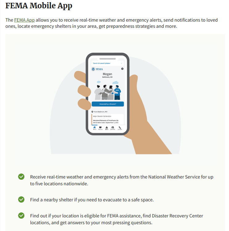
It is essential to stay informed about severe weather events by ensuring you receive real-time guidance from authorities. NOAA’s NWS provides active alerts by type of weather emergency and location, as well as NOAA Weather Radio broadcasts. Additional ways to receive the most up-to-date safety instructions are through real-time notifications available via the FEMA Mobile App, enabling Wireless Emergency Alerts (WEA) on your phone, and signing up to receive alerts from your local emergency management office.
