TUESDAY, SEPTEMBER 8, 2020 AS OF 2:00 PM EDT
According to the California Department of Forestry and Fire Protection (CAL FIRE), wildfires have burned approximately 2.2 million acres this year, accounting for eight fatalities and over 3,300 damaged or destroyed structures. There are currently 25 active wildfires burning in California, with roughly 14,100 firefighters working on the frontlines across California to contain them. California will remain under a Red Flag warning today into tomorrow.
The SCU Lightning Complex remains the largest active incident in the state of California; consuming 396,624 acres with 94 percent containment as of yesterday. CAL FIRE also listed the LNU Lightning Complex as the second-largest active incident; burning 375,209 acres with 91 percent containment as of 7:03 am Pacific Daily Time (PDT) this morning.
The Creek Fire in the Sierra National Forest, near Fresno, is the most recent active incident in the state. As of yesterday, it has consumed 78,790 acres and with 0 percent containment. CNN reported over 200 people were airlifted from the forest over the weekend due to the inferno. The fire has proven challenging to combat due to the remote terrain and hillside, and evacuations proved challenging due to the weather and smoke. Fresno County fire officials said dozens of people were still unable to leave the forest by themselves since the fire had blocked the avenues out, and people (including hikers and campers) were taking refuge in four areas.
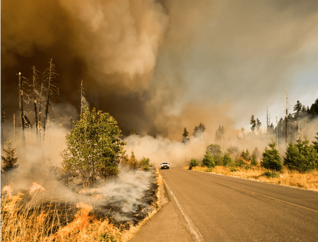
UnSplash: Marcus Kauffman
The Creek Fire blaze has forced evacuations in Fresno and Madera County, and United States (US) Forest Service Supervisor Dean Gould said the fire was an “unprecedented disaster” for Fresno County, as the conflagration was the “most aggressive” of any major wildfires that occurred in the area before. According to CNN, the wildfire has been responsible for extensive structural damage, and the intensity of the fire has prevented inspection teams from surveying exactly how many structures have been destroyed.
A number of areas of the state are under a Red Flag Warning for low humidity, and strong winds with gusts. A fire weather watch for critical fire weather was issued from CAL FIRE from the Inland empire into San Diego.
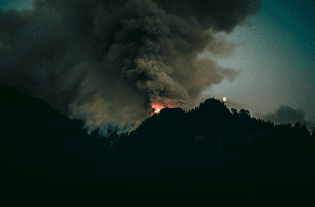
UnSplash: Luke Flynt
As seen with the recent burning across California, wildfires can ignite unexpectedly and burn quickly. It’s important to heed the warning of state and local authorities. Individuals in fire-prone areas should consider signing up for community alerts. The Federal Emergency Management Agency (FEMA) recommends building an emergency supply kit or “GoKit” using this ready.gov suggested Emergency Supply List ahead of a potential fire. Additionally, with regard to COVID-19, consider including hand sanitizer and face masks in your GoKit.
The Hagerty Blog Team will continue providing information and updates on current events and disasters impacting the nation, visit Disaster Discourse for the latest information.
Wildfires happen fast and you need to #BeReady to evacuate if local officials say it’s time to leave.
✅ Pack your to-go bag today
✅ Include hand sanitizer & face masks
✅ Sign up for emergency alerts from your communityhttps://t.co/g1UT5lw0XT https://t.co/JHUQOiCfUd— Readygov (@Readygov) September 8, 2020
FEMA on Wildfire Preparedness: Source
EVACUATIONS AND EMERGENCY DECLARATIONS
The Governor of California, Gavin Newsom, has declared a State of Emergency amid the scale and magnitude of fires that are burning throughout California.
Here’s the breakdown of public advisories from NOAA’s NWS in decreasing order of severity:
HIGH WIND WARNING:
- San Bernardino County-Upper Colorado River Valley
WIND ADVISORY:
- Cadiz Basin
- Death Valley National Park
- Eastern Mojave Desert, Including the Mojave National Preserve
- Morongo Basin
- Owens Valley
- Western Mojave Desert
- San Bernardino County-Upper Colorado River Valley
- North Bay Mountains
RED FLAG WARNING:
- Central Sierra
- Central Sierra Foothills
- Fort Tejon
- Lake Isabella
- North Kings River
- Sequoia Kings
- Southern Sierra Foothills
- Tehachapi Area
- Modoc County Except for the Surprise Valley
- Siskiyou County from the Cascade Mountains East and South to Mt Shasta
- Central Siskiyou County Including Shasta Valley
- Shasta-Trinity National Forest in Siskiyou County
- Western Klamath National Forest
- East Bay Hills and the Diablo Range
- North Bay Mountains
- Santa Cruz Mountains
- Orange County Inland
- Riverside County Mountains-Including The San Jacinto Ranger District Of The San Bernardino National Forest
- San Bernardino County Mountains-Including The Mountain Top And Front Country Ranger Districts Of The San Bernardino National Forest
- San Bernardino and Riverside County Valleys – The Inland Empire; San Diego County Inland Valleys
- San Diego County Mountains-Including The Palomar And Descanso Ranger Districts of the Cleveland National Forest
- San Gorgonio Pass Near Banning
- Santa Ana Mountains-Including The Trabuco Ranger District of the Cleveland National Forest
- Victor Valley – Apple Valley – Lucerne Valley – Johnson Valley
AIR QUALITY ALERT:
- Kern
- Ventura County Coast
- Ventura County Coastal Valleys
- Ventura County Interior Valleys
- Ventura County Mountains
- Fresno
- Kings
- Madera
- Merced
- San Joaquin
- Stanislaus
- Tulare
- Mariposa
- Tuolumne
RELATED STORIES
- Remember, Ready.gov provides information on how to prepare for Wildfire and how to keep you and your family safe.
- The Los Angeles Times regularly updated tracking of California Wildfires: California Wildfires Map.
- The National Fire Protection Association provides wildfire preparedness tips: link
- Marin County provides a wildfire evacuation checklist: link
- FEMA provides an information video about how to be prepared for Wildfires: link