SUNDAY, JUNE 7, 2020 AS OF 1:30 PM EDT
Tropical Storm Cristobal is expected to make landfall this afternoon on the Gulf Coast of Louisiana and currently has sustained winds of 50 miles per hour (mph). According to the National Oceanic and Atmospheric Administration’s (NOAA) National Weather Service (NWS), the storm is moving inland slowly at 10 nautical miles per hour (kt) as of 5 a.m. Eastern Daily Time (EDT). Cristobal is projected to maintain its tropical storm strength during landfall on Sunday. Cristobal will affect most of the Louisiana coastline, Mississippi, Alabama, Arkansas, and parts of the Florida panhandle. There is a danger of life-threatening storm surge from the Mouth of the Mississippi River to Ocean Springs, Mississippi.
Rainbands from #Cristobal are beginning to bring Tropical Storm conditions to portions of the northern U.S. gulf coast. Flooding from heavy rain and storm surge along the coast are the biggest hazards. https://t.co/tW4KeFW0gB https://t.co/SiZo8ohZMN pic.twitter.com/aiWYbphhLO
— National Hurricane Center (@NHC_Atlantic) June 7, 2020
Key Messages for Tropical Storm Cristobal: NWS Twitter
Bands of heavy rain caused by Cristobal are projected to cause flooding, storm surge, tornadoes, and strong winds to parts of the Gulf. On Saturday June, 7, bands brought extreme weather conditions and Tornado Warnings throughout Florida. Seven tornadoes were reported throughout the state, including one that touched down near downtown Orlando. These bands are now moving ashore to southeast Louisiana, northern Florida, and southern Georgia. Flash flood warnings are in effect in many states. Tornados are also possible in the Florida panhandle and eastern Louisiana as Cristobal continues to push inland. Additionally, Cristobal is projected to cause between two to four feet of storm surge in southeastern Louisiana and along the coast of Mississippi.
Do you know the difference between storm surge watches and warnings?
➡️A storm surge WATCH ? means that life-threatening inundation is possible within 48 hours.
➡️A storm surge WARNING ? means that there is danger of life-threatening inundation within 36 hours. pic.twitter.com/nXuGOMLbEU
— FL Division of Emergency Management (@FLSERT) June 6, 2020
Storm Surge Watches and Warnings : Florida Division of Emergency Management
The NWS offers advice and guidance for those about to experience, currently being impacted by, or previously affected by tropical storms and hurricanes. Individuals at-risk are encouraged to secure their home, remain up-to-date with the local NWS office and local government/emergency management office, and follow guidance issued by local officials. Additionally, the Federal Emergency Management Agency (FEMA) encourages individuals to prepare before a tropical storm or hurricane. The Hagerty Blog Team will continue providing information and updates.
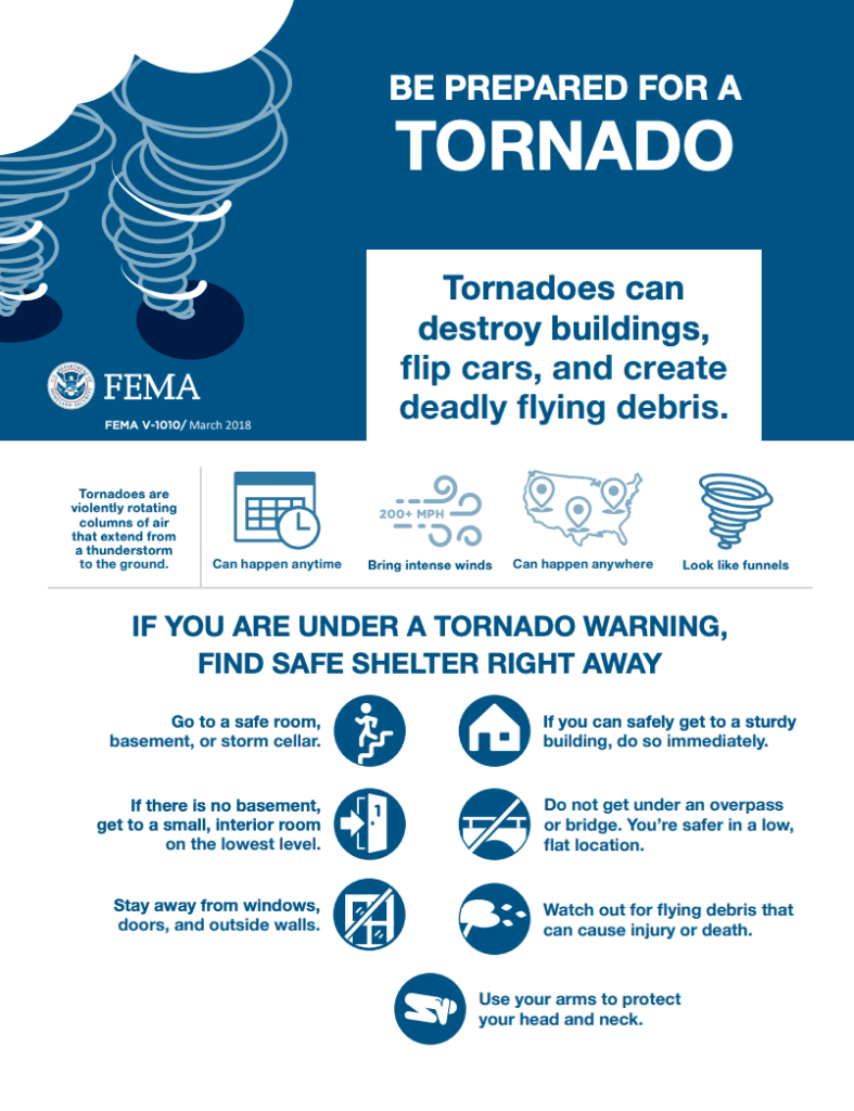
FEMA Guidance on Tornados: FEMA
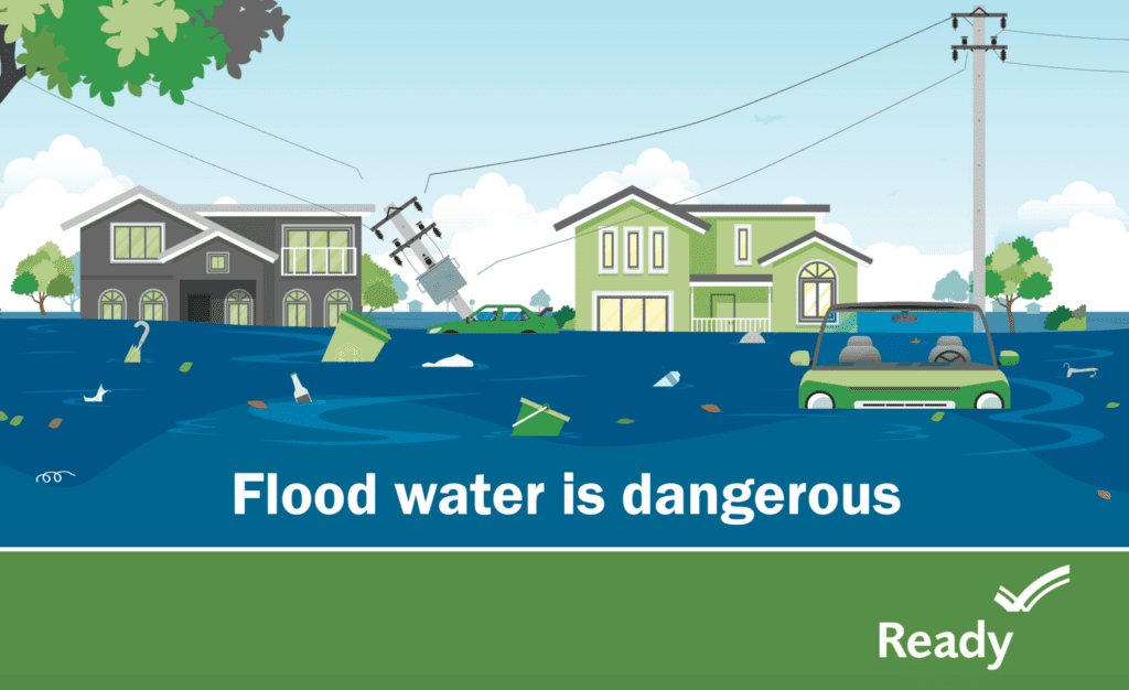
FEMA Guidance Flood Water: FEMA
PUBLIC ADVISORIES
- Here’s the breakdown of public advisories from NOAA’s NHC:
TROPICAL STORM WARNING:
RELATED STORIES
- Remember, Ready.gov provides information on how to prepare for a storm and how to keep you and your family safe
- COVID-19 Pandemic Operational Guidance for the 2020 Hurricane Season
Keep track of Hagerty’s coverage here:
HURRICANE SEASON 2020