FRIDAY, JULY 31, 2020 AS OF 3:30 PM EDT
According to the National Oceanic and Atmospheric Association (NOAA) National Hurricane Center (NHC), Hurricane Isaias is currently about 295 miles southeast of Nassau in the Bahamas, moving northwest at 16 mph with maximum sustained winds of 75 mph. Hurricane Isaias could result in heavy rain, flash flooding, and mudslides throughout the Dominican Republic, Turks and Caicos, northern Haiti, and the Bahamas on Friday, July 31 and Saturday, August 1. The Weather Channel reported winds gusts of over 50 mph in the Turks and Caicos on Thursday night and early Friday morning, while conditions have started to deteriorate in the central Bahamas. Several areas of Puerto Rico were hit with flash flooding, and 4.5 inches of rainfall were recorded in San Juan on Thursday.
Hurricane #Isaias will track through the Bahamas into Saturday and near Florida this weekend, before tracking up the East Coast next week: https://t.co/FPde9xZAac pic.twitter.com/Qo7ltTdJmX
— The Weather Channel (@weatherchannel) July 31, 2020
Tweet: The Weather Channel
The NHC cautioned that Isaias could produce 4 to 8 inches of rain across the Dominican Republic, the Bahamas, Turks and Caicos, and northern Haiti. The NHC estimated Isaias should reach the southern tip of Florida by Saturday at 8 pm EDT. Tropical storm warnings were issued for parts of the Florida Peninsula, including Miami, Fort Lauderdale, and West Palm Beach, while a hurricane watch was put in effect from Deerfield Beach to the Volusia-Brevard County line. Tropical storm conditions are anticipated to reach the eastern coast of the state on Saturday, August 1. The eastern Carolinas could face heavy rains associated with Isaias by early next week, with possible isolated flash and urban flooding, as the hurricane moves up the east coast.
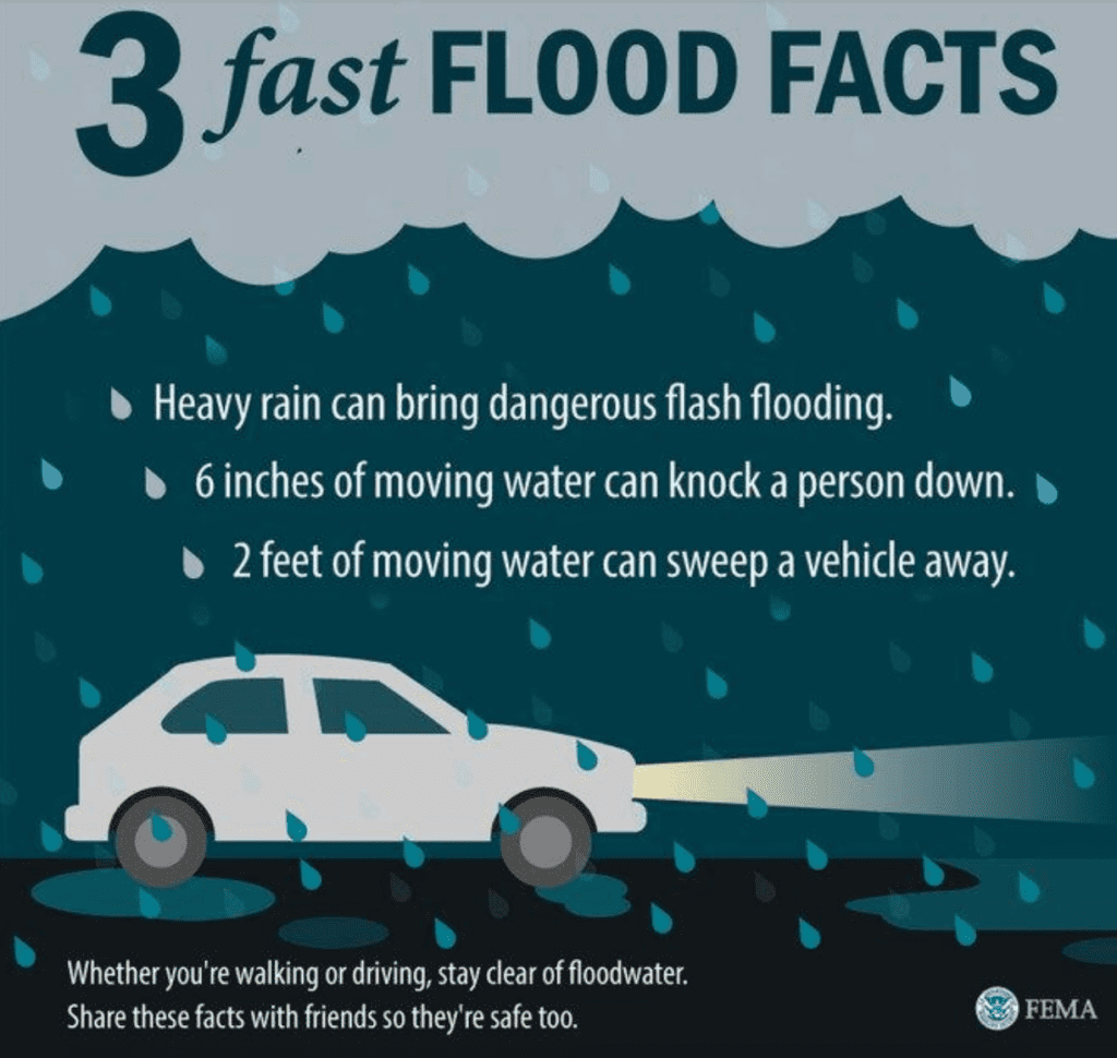
FEMA Guidance on Flash Flooding: Source
The Federal Emergency Management Agency (FEMA) provides guidance for individuals impacted by the inclement weather brought about by Hurricanes. It’s important to remember that flash floods can develop with little to no warning. It is imperative that individuals seek higher ground, and to avoid walking or driving in flood waters. Individuals should heed the warnings of local authorities and remain safe as Hurricane Isaias approaches. The Hagerty Blog Team will continue providing information and updates.
PUBLIC ADVISORIES
Here’s the breakdown of public advisories from NOAA’s NHC:
HURRICANE WARNING:
TROPICAL STORM WARNING:
RELATED STORIES
- Remember, during a storm, it is important to follow the directions of your state and local officials. Ready.gov provides information on how to prepare for a storm and how to keep you and your family safe throughout.
- Understanding the meaning of hurricane maps – a NY Times Opinion Piece: Those Hurricane Maps Don’t Mean What You Think They Mean
Keep track of Hagerty’s coverage here:
HURRICANE SEASON 2020