WEDNESDAY, AUGUST 26, 2020 AS OF 9:00 AM EST
According to the National Oceanic and Atmospheric Association’s (NOAA) National Hurricane Center (NHC), Hurricane Laura is moving northwest towards the gulf coast of Texas and Louisiana with max sustained winds of 110 miles per hour (mph). According to the NOAA NHC, Laura is centered just over 300 miles south-southeast of Lake Charles, Louisiana and is tracking northwest at 15 mph. Laura is currently a Category 3 Hurricane and is predicted to rapidly strengthen to a Category 4 Hurricane today, Wednesday August 26 before making landfall. Laura is predicted to make landfall along southwest Louisiana and Texas’ northernmost coastline this evening or early Thursday morning. States of emergency were declared earlier this week ahead of Hurricane Marco and Laura in Louisiana and Mississippi. On Sunday, August 23, Texas Governor Greg Abbot issued Disaster Declarations for 23 Counties ahead of Marco and Laura.
?️ #Hurricane #Laura has rapidly intensified overnight with max sustained winds of 110 mph as of 4am. Infrared satellite imagery shows an eye beginning to become visible.
Continue to monitor @NHC_Atlantic at https://t.co/gWlc0oGslO for the latest information.#HOUwx #TXwx #LAwx pic.twitter.com/K2LMqRYoYn
— NWS Houston (@NWSHouston) August 26, 2020
Twitter: NHC
The NOAA NHC warns that Laura is expected to bring life-threatening storm surge, dangerous waves, extreme winds, and flash flooding from San Luis Pass, Texas, to the Mouth of the Mississippi River, causing potential catastrophic damage to the area. NHC reports that storm surge from Hurricane Laura could travel as much as 30 miles inland. Additionally, Storm Surge Warnings have been issued for Freeport, Texas to the mouth of the Mississippi River. A Storm Surge Watch is currently in effect for; the Mouth of the Mississippi River to Ocean Springs Mississippi; Lake Pontchartrain, Louisiana; Lake Maurepas, Louisiana; and Lake Borgne, Louisiana. Voluntary and mandatory evacuations are taking place along the coast of Texas. Hagerty encourages its readers to follow state and local directives and prepare ahead of time for potential impacts. Laura is already responsible for nine deaths as it moved through the Caribbean earlier this week.
A life-threatening storm surge is forecast to occur with #Laura. The water could reach the following heights above ground somewhere in the indicated areas. This storm surge could penetrate up to 30 miles inland from the immediate coastline in SW Louisiana and far SE Texas. pic.twitter.com/tZHOksgtrQ
— National Hurricane Center (@NHC_Atlantic) August 26, 2020
Twitter: NHC
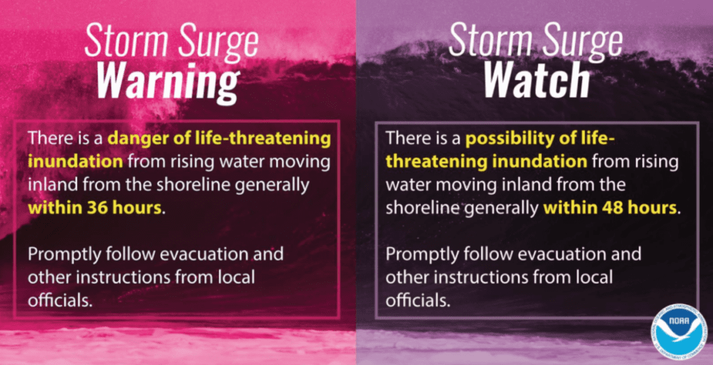
NOAA Guidance on Storm Surge: Source
Federal Emergency declarations have also been approved for Louisiana, Mississippi, and Texas. These declarations help the Federal Emergency Management Agency (FEMA) to rapidly and efficiently respond when states and individuals need aid after a disaster. They authorize FEMA to provide assistance, including reimbursement for mass care, evacuation and shelter support.
Additionally, FEMA provides guidance to individuals preparing for, experiencing, or affected by hurricanes. Hurricane Laura brings potential for life-threatening storm surge to many coastal communities. Individuals should heed the warnings of local authorities and prepare for hurricane and severe weather conditions.
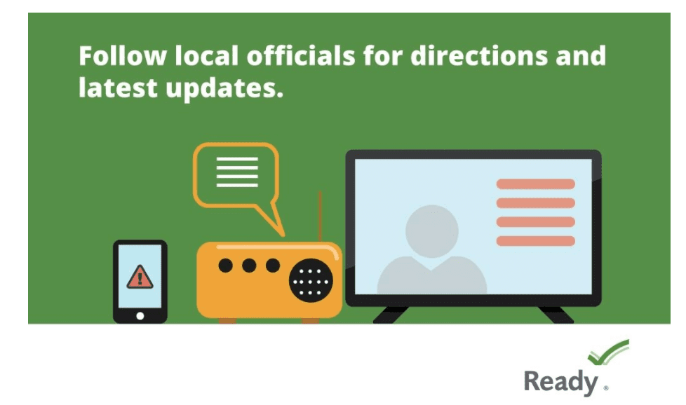
The Ready Campaign: Source
PUBLIC ADVISORIES
Here’s the breakdown of public advisories from NOAA’s NHC:
HURRICANE WARNING:
- Gulf of Mexico
- San Luis Pass Texas to Intracoastal City Louisiana
TROPICAL STORM WARNING:
- Gulf of Mexico
- Sargent Texas to San Luis Pass
- East of Intracoastal City Louisiana to the Mouth of the Mississippi River
STORM SURGE WARNING:
- Freeport, Texas to the Mouth of the Mississippi River
- San Luis Pass, Texas
HURRICANE WATCH:
- East of Intracoastal City to west of Morgan City Louisiana
STORM SURGE WATCH:
- Mouth of the Mississippi River to Ocean Springs Mississippi
- Lake Pontchartrain, Lake Maurepas, and Lake Borgne, Louisiana
RELATED STORIES
- Remember, during a storm, it is important to follow the directions of your state and local officials. Ready.gov provides information on how to prepare for a storm and how to keep you and your family safe throughout.
- Understanding the meaning of hurricane maps – a NY Times Opinion Piece: Those Hurricane Maps Don’t Mean What You Think They Mean
Keep track of Hagerty’s coverage here:
HURRICANE SEASON 2020