FRIDAY, AUGUST 28, 2020 AS OF 10:00 AM EDT
Tropical Depression Laura is currently tracking inland from Arkansas to the Lower Ohio Valley, moving northeast at approximately 13 miles per hour (mph) with maximum sustained winds near 30 mph. Throughout Friday evening, the National Oceanic and Atmospheric Administration’s (NOAA) National Hurricane Center (NHC) cautioned that Laura could produce rainfall between one to three inches (with isolated area receiving as much as five inches) across northeastern Arkansas, northern Mississippi, northern Alabama, western and middle Tennessee, southeastern Missouri, and western and central Kentucky. Tornados may develop on Friday afternoon into the evening across parts of the mid-South and Tennessee Valley regions, while swells caused by Laura could impact the north-central and northeast Gulf Coast with possible life-threatening surf and rip current conditions.
5AM advisory is in and #laura is losing tropical characteristics but continues to bring flooding concerns. There are two other areas we are watching with the potential for tropical cyclone development in the next 5 days. Take a look. pic.twitter.com/YYsbTG5k1D
— Julie Durda (@JulieDurdaWPLG) August 28, 2020
Twitter: Julie Durda
The Weather Channel reported that wind gusts of 100 to 135 mph impacted southwestern Louisiana near the eye of the storm. The former Category 4 storm, Hurricane Laura, was the seventh named storm to hit the United States (US) this year and was one of the most powerful to hit the Gulf Coast in decades, with at least six fatalities directly caused by the storm, according to the Associated Press.
Damage from downtown Lake Charles, located in southwestern Louisiana, included significant flooding, a number of buildings destroyed by the storm, and an industrial plant for chlorine-based products caught on fire and required a shelter-in-place order, according to The Washington Post. The storm knocked out power for customers in several states; with New Orleans-based Entergy Corporation reporting periodic power outages for 231,000 customers across Texas and 262,000 outages for customers in Louisiana as of 4 pm CDT on Thursday.
I always find that Before/After pictures can really put things into perspective. #Laura and its destructive winds leaving this building in Lake Charles, LA basically window free! pic.twitter.com/ZFuFdweCLb
— Alex Wallace (@TWCAlexWallace) August 27, 2020
Twitter: Alex Wallace
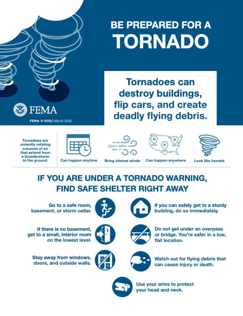
FEMA Guidance on Tornados: Source
The NWS offers advice and guidance for those about to experience, currently being impacted by, or previously affected by tropical storms and hurricanes. Individuals at-risk are encouraged to secure their home, remain up-to-date with information from the local NWS office and local government/emergency management office, and follow guidance issued by local officials. As Laura continues to move across many US states, states and communities should begin preparing for tropical storm-like weather and potential tornadoes. The Hagerty Blog Team will continue providing information and updates.
RELATED STORIES
- Remember, during a storm, it is important to follow the directions of your state and local officials. Ready.gov provides information on how to prepare for a storm and how to keep you and your family safe throughout.
- Understanding the meaning of hurricane maps – a NY Times Opinion Piece: Those Hurricane Maps Don’t Mean What You Think They Mean
Keep track of Hagerty’s coverage here:
HURRICANE SEASON 2020