Tropical Storm Hanna, the eighth named storm of the 2020 Atlantic Hurricane season, formed in the Gulf of Mexico on July 22. According to the National Oceanic and Atmospheric Association (NOAA) National Hurricane Center (NHC), Hanna is moving west-northwest at approximately nine mph with sustained winds up to 40 mph. The storm is expected to make a westward turn this evening and sustain that direction throughout the weekend. Tropical Storm Hanna is expected to strengthen before making landfall along the Texas coast on Saturday.
Hanna is expected to generate strong swells off the Texas and Louisiana coast over the next few days, creating life-threatening surfing and rip current conditions. Areas along the Texas and Louisiana coast can expect tropical storm conditions through Saturday morning as Hanna is expected to produce heavy rain in the area, with isolated areas in south Texas experiencing as much as 12 inches of rainfall. Flash flooding and isolated river flooding is possible in certain areas of south Texas.
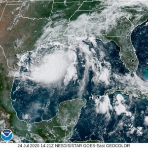 NOAA Geostationary Operational Environmental Satellite (GOES) Tropical Storm Hanna Timelapse 6:30 – 7:30 AM CT: Source
Additionally, in the Pacific, Hurricane Douglas rapidly intensified to a Category 3 hurricane, with sustained wind speeds near 120 mph, according to NHC. At present, Douglas is located approximately 1,000 miles east-southeast of Hilo, Hawaii, moving west-northwest toward the Hawaiian Islands. Hurricane Douglas is expected to maintain this direction throughout the weekend. According to NHC, the hurricane will reach the islands on Sunday, July 26. As Douglas crosses into cooler waters this weekend, the hurricane is expected to considerably weaken. Despite the potential for weakening, residents of the Hawaiian Islands can expect tropical storm-like conditions, including heavy rainfall, flooding, and rip current conditions.
Hurricane #Douglas is a massive Category 4 storm churning nearly 1,000 miles away from the Hawaiian Islands in the open waters of the Pacific Ocean currently. The storm will begin to weaken as it tracks into cooler water as it nears the island chain: https://t.co/iXCzcveMqW pic.twitter.com/ynYdZgR1bC
— AccuWeather (@breakingweather) July 24, 2020
Tweet: AccuWeather
Yesterday, Hawaii Governor David Ige declared an emergency disaster declaration and signed a proclamation in preparation for potential impacts caused by the tropical cyclone, with a relief period to remain in effect through the week (ending July 31). Hawaiian residents should continue to monitor the progress of Hurricane Douglas and heed the guidance of local authorities.
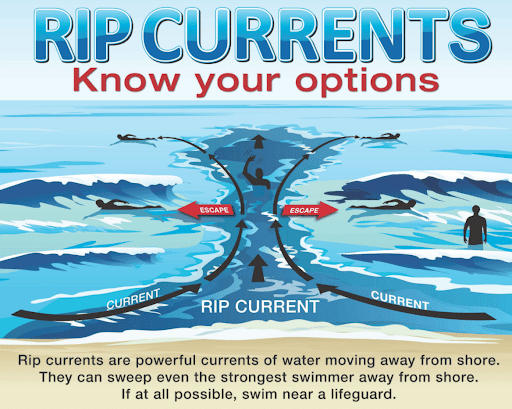
Rip Currents Know Your Option: Source
The NHC encourages individuals to check water conditions before going in water. Coastal residents should always consult local beach forecasts before traveling to the beach, especially during inclement weather. Storms bring the potential for strong rip currents which are naturally occurring, fast flowing channels of water that extend from close to the shoreline through the surf and past the breaking waves. To learn more, watch NHC’s online training videos on rip current safety. The Hagerty Blog Team will continue providing relevant disaster and incident coverage throughout the 2020 Hurricane Season.
PUBLIC ADVISORIES
Here’s the breakdown of public advisories from NOAA’s NHC:
HURRICANE WARNING:
TROPICAL STORM WARNING:
RELATED STORIES
- Remember, Ready.gov provides information on how to prepare for a storm and how to keep you and your family safe.
- Understanding the meaning of hurricane maps – a NY Times Opinion Piece: Those Hurricane Maps Don’t Mean What You Think They Mean
Keep track of Hagerty’s coverage here:
HURRICANE SEASON 2020