TUESDAY, AUGUST 4, 2020 AS OF 5:00 PM EDT
According to the National Oceanic and Atmospheric Association (NOAA) National Hurricane Center (NHC), the center of Tropical Storm Isaias is located over Pennsylvania, with maximum sustained winds near 70 mph. The mid-Atlantic coast could experience widespread sustained tropical storm force winds, and potentially hurricane force winds, throughout Tuesday, August 4. Heavy rainfall across the east coast, leading to flash flooding in many areas. The storm made landfall close to Ocean Isle Beach, North Carolina, as a Category 1 hurricane at 11:10 p.m. EDT on Monday, according to The Weather Channel.
#Isaias have proven to be a prolific tornado producer the past 24 hours
.@NWS offices have already issued nearly 100 tornado warnings across 10 states pic.twitter.com/FtzSTALOTa
— Greg Diamond (@gdimeweather) August 4, 2020
Isaias Tornado Warnings: Twitter
Isaias has created a number of tornadoes over parts of the mid-Atlantic coast, this tornado-threat is expected to continue along the mid-Atlantic coast and spread across New England Tuesday afternoon. According to the NHC, widespread sustained tropical storm force winds and gusts to hurricane force are anticipated along the mid-Atlantic coast, while heavy rainfall could result in minor-to-moderate river flooding across portions of mid-Atlantic, with quick-responding rivers in the Northeast particularly susceptible. New England is expected to have tornado threats that last throughout the afternoon; the New York Harbor Entrance buoy reported sustained winds of 54 mph, with gusts reaching up to 63 mph. The Weather Channel noted the National Weather Service issued 96 tornado warnings for 10 states on the east coast, including Maryland, Delaware, New Jersey, and New York, with more than a dozen reports of tornadoes already recorded since the evening of August 3.
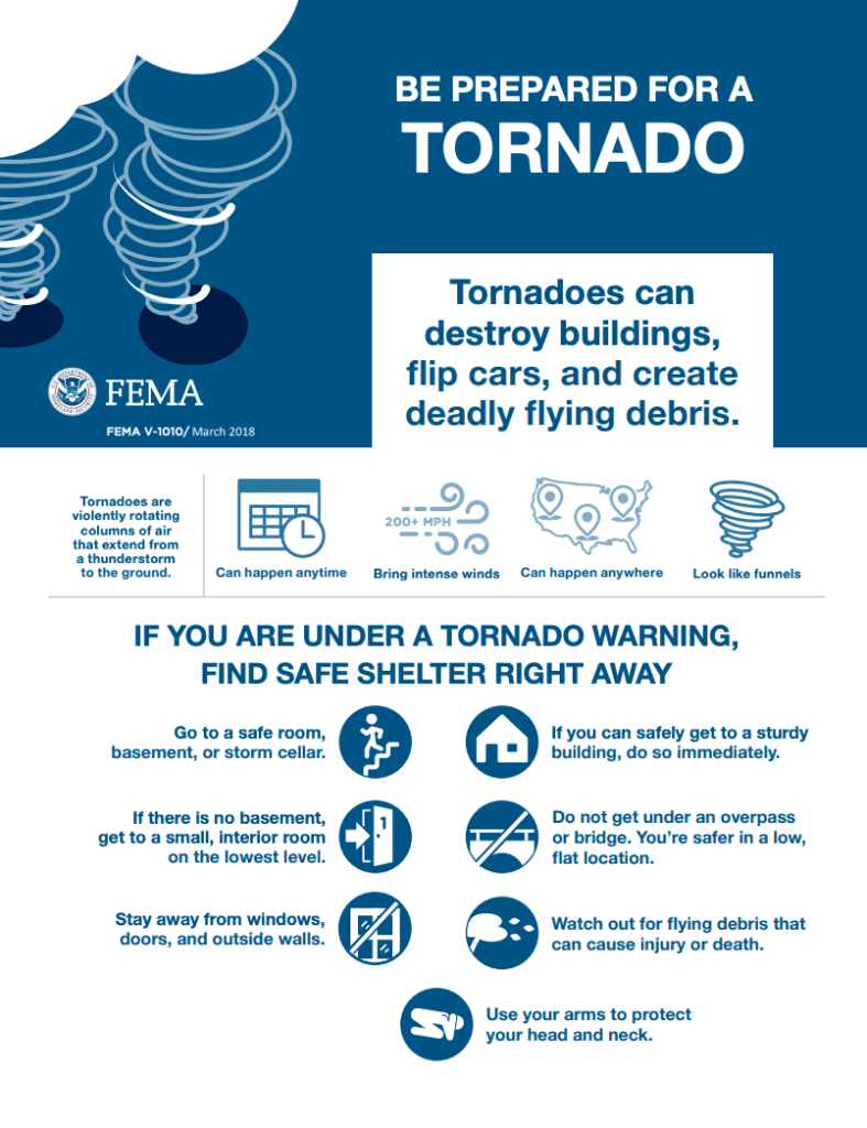
FEMA Guidance on Tornados: FEMA
The Federal Emergency Management Agency (FEMA) encourages individuals to take the necessary precautions and prepare for tornadoes. Tornadoes can appear suddenly, destroy buildings, flip cars, and create deadly flying debris. FEMA suggests individuals under Tornado Warnings seek shelter right away.
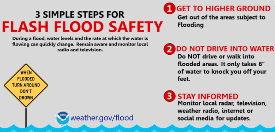
FEMA Flood Safety: Source
FEMA also provides instruction for individuals to prepare before a Tropical Storm or Hurricane, cautioning them to prepare in advance for extreme weather conditions. It is crucial to know that flash floods can develop with little to no warning, and individuals should seek out higher ground, avoiding walking or driving in flood waters, and listen to the warnings of local authorities. The Hagerty Blog Team will continue providing relevant disaster and incident coverage throughout the 2020 Hurricane Season.
PUBLIC ADVISORIES
Here’s the breakdown of public advisories from NOAA’s NHC:
TROPICAL STORM WARNING:
- Atlantic
- North of Duck North Carolina to Eastport Maine
- Chesapeake Bay
- Tidal Potomac River
- Delaware Bay
- Long Island and Long Island Sound
- Martha’s Vineyard, Nantucket, and Block Island
RELATED STORIES
- Remember, during a storm, it is important to follow the directions of your state and local officials. Ready.gov provides information on how to prepare for a storm and how to keep you and your family safe throughout.
- Understanding the meaning of hurricane maps – a NY Times Opinion Piece: Those Hurricane Maps Don’t Mean What You Think They Mean
Keep track of Hagerty’s coverage here:
HURRICANE SEASON 2020