TUESDAY, SEPTEMBER 14, 202 AS OF 11:30 AM EDT
Tropical Storm Nicholas is approximately 15 miles south-southwest of Houston, moving slowly toward the Houston Metropolitan Area in Texas, according to the National Oceanic and Atmospheric Administration’s (NOAA’s) National Hurricane Center (NHC). Nicholas made landfall as a hurricane shortly after midnight roughly 10 miles west southwest of Sargent Beach,Texas, with wind speeds of 75 mph, but has since been downgraded to a Tropical Storm. Nicholas is moving slowly north-northeast at 8 miles per hour (mph), with maximum sustained winds of 60 mph. Tropical storm force winds reach outward up to 125 miles from the center of the storm, and life-threatening flash floods are forecast across the Deep South, ranging from the upper Texas coastal area to southern Louisiana, Mississippi, and Alabama for the next two days.
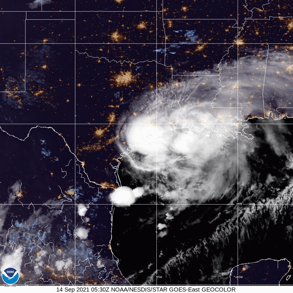
River flooding is also anticipated over parts of the upper Texas Gulf Coast and southern Louisiana to Mississippi, while Nicholas may also produce rainfall of 5 to 10 inches from the upper Texas coastal area towards central to southern Louisiana, far southern Mississippi, and far southern Alabama. There is additionally a risk of one to two tornadoes across the upper Texas Coast to southern Louisiana. The storm is anticipated to weaken further on Tuesday as it moves deeper inland, and Nicholas is projected to become a tropical depression by Wednesday morning.
9 AM Radar Update:
Tropical Storm #Nicholas continues to move slowly north-northeast across our region this morning. Light to moderate rain will continue along and east of I-45 through this afternoon/early evening.
Green polygon= Flash Flood Warning#txwx #houwx #glswx pic.twitter.com/s9q4nfOrfO
— NWS Houston (@NWSHouston) September 14, 2021
Radar Update from the NWS covering the Houston/Lake Charles Region: Twitter
As of 9 am CDT, the Houston Chronicle reported that 420,000 Texas residents were without power following Nicholas’ landfall. CenterPoint Energy, the managing agency for Harris County and surrounding areas, encourages residents to report outages to assist in the damage assessment and power restoration efforts already underway. Additionally, the power company recommends that Texas residents stay 10 feet away from downed power lines to prevent accidental electrocution or other harmful effects. Houston Mayor Sylvester Turner encouraged Houston residents to continue watching weather reports and to follow social media channels for the Houston Office of Emergency Management (OEM) to keep updated on flooding and power outage impacts as Tropical Storm Nicholas passes through the City. He announced on Tuesday morning that he was meeting with OEM to discuss the overnight impact of the storm and to coordinate debris removal to bring Houston back to normal operations.
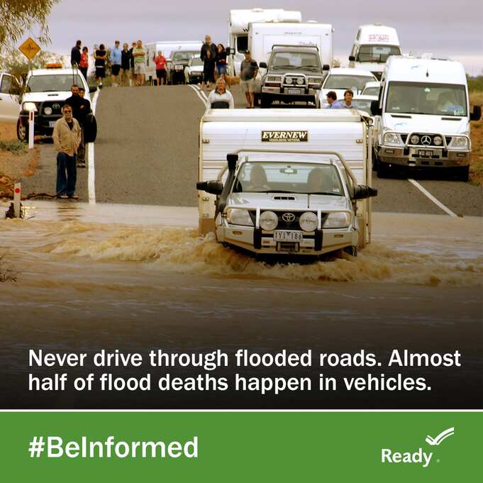
Federal Emergency Management Agency (FEMA):Ready Flooded Roads
As Nicholas continues to move along the coast and inland, states and communities should begin preparing for tropical storm-like weather and flooding. The Federal Emergency Management Agency (FEMA) encourages individuals to take the necessary precautions and prepare for flash flooding. Flash floods can develop with little to no warning, quickly changing the surrounding area. FEMA suggests individuals seek higher ground, avoid walking or driving in flood waters, and heed the warnings of local authorities. Additionally, the National Weather Service (NWS) offers advice and guidance for those about to experience, currently impacted by, or previously affected by tropical storms and hurricanes. Individuals at risk are encouraged to secure their home, remain up-to-date with information from their local NWS office and local government/emergency management office, and follow guidance issued by local officials.
RELATED STORIES
STAY UPDATED AND LEARN MORE HERE:
- Remember, Ready.gov provides information on how to prepare for a storm and how to keep you and your family safe.
- Understanding the meaning of hurricane maps – a NY Times Opinion Piece: Those Hurricane Maps Don’t Mean What You Think They Mean

Keep track of Hagerty’s incident coverage here: