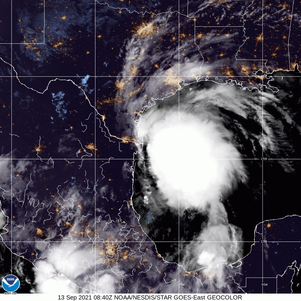
According to the National Oceanic and Atmospheric Administration’s (NOAA) National Hurricane Center (NHC), Tropical Storm Nicholas is approximately 45 miles northeast of the mouth of the Rio Grande and approximately 140 miles south of Port O’Connor, Texas, moving north at 12 miles per hour (mph), with maximum sustained winds of 60 mph.
Nicholas is expected to make landfall along portions of the middle Texas coast as soon as Monday afternoon, including possible hurricane conditions extending from Port Aransas to San Luis Pass through the evening. Intense winds are projected to create dangerous storm surge conditions from San Luis Pass to Sabine Pass, including Galveston Bay; all areas that are currently under a Storm Surge Warning. Significant rainfall accumulation is expected across portions of the Texas and Louisiana coasts through the middle of the week, and the rain may cause flash and urban flooding, as well as moderate river flooding. Meteorologists are carefully monitoring Nicholas’s intensity over the course of the day on Monday, however, the conditions are expected to begin subsiding as the storm moves inland on Tuesday, according to National Hurricane Center senior specialist Eric Blake, as reported by Yahoo News.
With Tropical Storm Nicholas projected to make landfall in Texas, Governor Greg Abott declared a state of emergency on September 11, deploying resources throughout the Gulf Coast to assist residents preparing for possible flooding, search and rescue operations, and medical needs. Louisiana Governor John Bel Edwards declared a state of emergency ahead of the storm as well, anticipating significant potential for heavy rains and flash flooding throughout the state. On Sunday, Governor Abott and Governor Bel Edwards shared resources from the National Weather Service (NWS) to keep residents updated, including notices to avoid floodwaters, heed local warnings, and monitor emergency evacuation orders as they change.
‼️Enhanced Risk‼️
With more heavy rainfall & the threat of flash flooding expected to impact a large portion of Texas this week from Tropical Storm Nicholas, make sure to continue to:
✔️Monitor Local Weather
✔️Avoid High Water
✔️Heed Local Warnings
Turn Around, Don’t Drown pic.twitter.com/m98yYpNoBO— Texas Division of Emergency Management (@TDEM) September 12, 2021
Tropical Storm Nicholas Projection across the Gulf Coast: Texas Division of Emergency Management
According to Bel Edwards, Louisiana residents, especially those impacted by Hurricane Ida two weeks prior, should continue to follow emergency orders and be aware of the possible destruction created by this storm as the state continues to recover from that disaster. As of Monday morning, over 116,000 Louisianans remain without power following Hurricane Ida’s destructive winds and rain, according to PowerOutage.us.

FEMA Flood Safety: Source
As Tropical Storm Nicholas moves across the southern and middle coast of Texas, there is an increased chance of flash flooding, storm surge, and gusty winds. The Federal Emergency Management Agency (FEMA) encourages individuals to take the necessary precautions and prepare for flash flooding. Flash floods can develop with little to no warning, quickly changing the surrounding area. FEMA suggested individuals seek higher ground, avoid walking or driving in flood waters, and heed the warnings of local authorities.
The Hagerty Blog Team will continue providing information and updates on current events and disasters impacting the nation. Visit Disaster Discourse for the latest information.
RELATED STORIES
STAY UPDATED AND LEARN MORE HERE:
- Remember, Ready.gov provides information on how to prepare for a storm and how to keep you and your family safe.
- Understanding the meaning of hurricane maps – a NY Times Opinion Piece: Those Hurricane Maps Don’t Mean What You Think They Mean

Keep track of Hagerty’s incident coverage here: