THURSDAY, OCTOBER 8, 2020 AS OF 3:30 PM EDT
According to the National Oceanic and Atmospheric Administration National Hurricane Center (NOAA NHC), Hurricane Delta is a Category 2 hurricane with maximum sustained wind speeds of 105 miles per hour (MPH). As of mid-day Thursday, October 8, Delta is moving north westward across the Gulf of Mexico. Delta is currently located approximately 400 miles south of Cameron, Louisiana moving toward the Gulf Coast. Hurricane-force winds extend outward approximately 35 miles from the eye of the storm and its tropical-storm-force winds extend outward to 125 miles. The storm is expected to make landfall over the Texas and Louisiana coast on Friday, October 9 and is the 25th named storm of the 2020 Atlantic Hurricane Season. Due to an overactive hurricane season, meteorologists are naming storms according to the Greek alphabet. This is only the second time in named-hurricane history that this has happened. The previous occurrence was in 2005 and six Greek alphabet names were used.
According to the NHC, life-threatening storm surge is possible where the storm makes landfall and surrounding areas. Storm surge warnings are in effect from High Island Texas to Ocean Springs Mississippi.
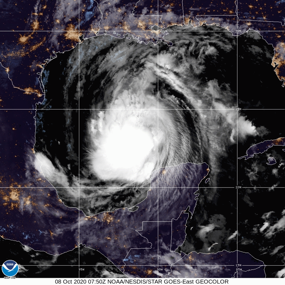
NOAA: Hurricane Delta
On October 7, the President approved Louisiana Governor John Bel Edwards’ request for a federal emergency declaration in advance of Hurricane Delta, “which is forecast to make landfall along Louisiana’s coastline.” According to the Associated Press, Gov. Edwards reached out to residents ahead of Delta’s expected arrival via text messages and a robocall saying they should “prepare now — have your emergency plans in place.”.
Communities now preparing for the storm are coastal areas still recovering from Hurricanes Sally and Laura, which have impacted the US Gulf Coast earlier this season.
Weather conditions will deteriorate well ahead of the arrival of the center of Hurricane #Delta. Tropical-storm-force winds, which can make preparations dangerous to complete, are expected to arrive along portions of the northern Gulf Coast shortly after sunrise Friday. pic.twitter.com/sOIuT5A2bI
— National Hurricane Center (@NHC_Atlantic) October 8, 2020
Twitter: NOAA NHC
Meanwhile, the unprecedented fire season in California has reached a new milestone — the August complex fire in northern California spread to over one million acres, upgrading the blaze from a megafire to a gigafire, the first in the country since 2004’s Taylor Complex in Alaska.
The California Department of Forestry and Fire Protection (Cal Fire) reported the fire is approximately 60 percent contained. As of Wednesday, Cal Fire noted firefighters were working on containment for 22 major wildfires and one extended attack wildfire across the state. To date, more than 4.04 million acres have burned as a result of 8,320 incidents. There have been 31 fatalities as a result of the fires, with 9,247 structures damaged or destroyed.
Air quality alerts have been issued across the northwest United States (US). The NOAA National Weather Services (NWS) issued air quality alerts for wildfire smoke in Wyoming, including the counties of Albany, Laramie, Platte, Goshen, and Converse, as well as most of Carbon county, as a result of heavy smoke from the Mullen and Cameron Peak wildfires. Air quality alerts are also in place for most of central California, and the NOAA NWS cautioned the alerts were a result of wildfires in the Sierra Nevada and other adjacent areas.
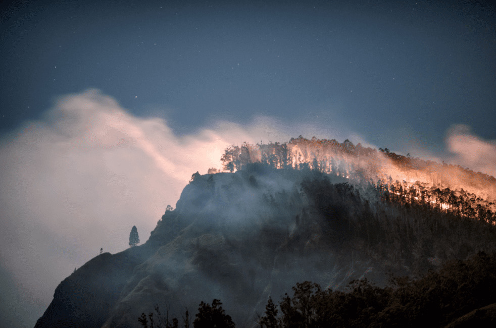
Unsplash: Kitera Denta
Policymakers and fire-event experts have started to abandon traditional containment strategies to focus instead on prescribed burning, which relies on intentionally starting less intense fires that can be controlled in overgrown areas. To change strategies from traditional methods to prescribed burning, officials have turned to indigenous people groups and their respective organizations, such as the nonprofit Lomakatsi Restoration Project, for fundamental ecological principles used to contain wildfires. This includes the increase in prescribed burning. In a statement, Barnie Gyant, Deputy Regional Forester for the Forest Service Pacific Southwest Region, said “…our commitment at the Forest Service is to work with tribal partners to achieve healthy and resilient landscapes.”.
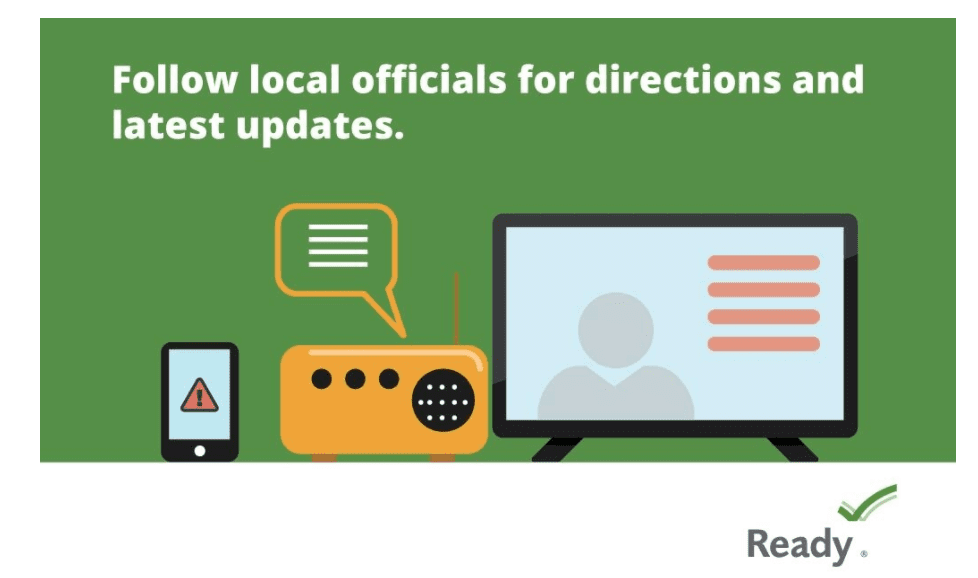
The Ready Campaign: Source
The Federal Emergency Management Agency (FEMA) provides guidance to individuals preparing for, experiencing, or affected by hurricanes. Hurricane Delta brings the potential for life-threatening storm surge to many coastal communities. Individuals should heed the warnings of local authorities and prepare for hurricane and severe weather conditions.
Additionally, NOAA provides information on Storm Surge Warnings and Storm Surge Watch. If you are under a warning or watch, make sure to seek higher ground. Storm surge can pose a life-threatening danger from rising water filled with debris.
PUBLIC ADVISORIES
To get a breakdown by State and County of public advisories from NOAA’s NWS in decreasing order of severity, click here.
RELATED STORIES
- Remember, Ready.gov provides information on how to prepare for Wildfire and how to keep you and your family safe.
- The Los Angeles Times regularly updated tracking of California Wildfires: California Wildfires Map.
- The National Fire Protection Association provides wildfire preparedness tips: link
- Marin County provides a wildfire evacuation checklist: link
- FEMA provides an information video about how to be prepared for Wildfires: link
- Understanding the meaning of hurricane maps – a NY Times Opinion Piece: Those Hurricane Maps Don’t Mean What You Think They Mean