TUESDAY, AUGUST 23, 2022 AS OF 1:00 PM EST
Torrential rains caused historic flash flooding across the City of Moab, Utah and surrounding areas on the evening of Saturday, August 20. This was due to almost one inch of rain falling in a 20-minute time span, causing hazard situations throughout the city. According to the National Oceanic and Atmospheric Administration (NOAA) National Weather Service (NWS), a total of 1.66 inches of rain fell between 7:00 pm and 9:00 pm MDT. According to Chuck Williams, a City of Moab engineer, this extreme weather event qualifies as a 100-year flood, as reported by KUTV. In response, the City of Moab and Grand County officials issued emergency declarations, closed several unsafe roads and trails. Cities have made free sheltering and clean drinking water available for impacted homes and businesses in the downtown area.
UPDATE: 500 West at the bridge near Anonymous Park is closed and more water is expected. Please avoid areas near creeks; watch for possible flooding if you live in the area. This video shows Mill Creek at the bridge a Main Street several minutes ago. Please Take Extreme Caution. pic.twitter.com/AJfnIiJwts
— City of Moab, Utah (@CityofMoab) August 21, 2022
Twitter: City of Moab, Utah
Elsewhere in Utah, rescuers continue to search for a woman who went missing while hiking at Zion National Park on Friday, August 19. According to reports, the woman did not return to her lodging that evening after visiting The Narrows, one of the most popular areas of the park and also the narrowest section of Zion Canyon. At approximately 2:15 pm MDT on Friday, park officials received a report that several hikers were impacted by a flash flood in the area, although at that time there were no visitors reported missing. Rescuers did transport one other person to an area hospital after finding them injured near the Temple of Sinawava. The National Park Service (NPS) has issued a news release providing updates on park closures and search and rescue efforts.
There are reports of high water over many DFW roadways, especially city streets. Despite the heaviest rainfall moving further south, flooding will continue where heavy rain has fallen. Do not drive into flooded roadways, and avoid traveling if at all possible. #dfwwx #txwx pic.twitter.com/yRa3LvTEU9
— NWS Fort Worth (@NWSFortWorth) August 22, 2022
Twitter: NWS Fort Worth
In addition, severe storms in North Texas have prompted numerous water rescues as rainfall totals in some areas would qualify as a one-in-one-thousand-year flood. According to the NWS, flood warnings began Sunday evening, August 21, as a storm system intensified heavy rains across the Dallas-metropolitan and Fort Worth areas. In the eastern Dallas area, nearly 14 inches of rain was recorded in just 12 hours according to Harris County meteorologist Jeff Lindor. The Fort Worth Fire Department reported over 130 high water calls by midday Monday, August 22, with crews actively responding to 38 different scenes. As rain continued to fall in and around the area, the NWS in Fort Worth issued warnings for continued risk of dangerous and life-threatening flooding until Monday afternoon, August 22.
East of Dallas, Shreveport and Monroe, Louisiana, and Nachez, Mississippi, are also bracing for extreme weather conditions as heavy rainfalls move across the Mississippi Valley. A flood watch has been issued until 7pm on Tuesday, August 23, with rainfall totals anticipated to reach between four and six inches in Northern Louisiana. The Southwestern Electric Power Company, which supplies a majority of homes in the region spanning from Dallas, Texas to Nachez, Mississippi, reported at noon on August 22 that over 4,800 customers remained without power due to heavy rain and down trees. The Louisiana Governor’s Office of Homeland Security and Emergency Preparedness (GOHSEP) maintains a list of resources for updating residents on changing conditions, including the RAVE Mobile Safety alerts and notifications system to keep the public up-to-date on extreme weather events.
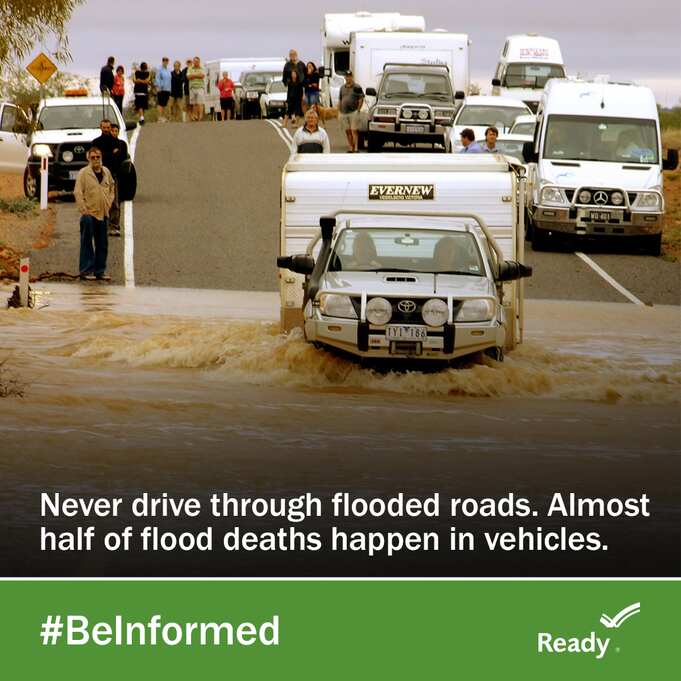
Federal Emergency Management Agency (FEMA) : Ready Flooded Roads
FEMA encourages individuals to take the necessary precautions and prepare for flash flooding. Flash floods can develop with little to no warning, quickly changing the surrounding area. FEMA suggests individuals seek higher ground, avoid walking or driving in flood waters, and heed the warnings of local authorities. To stay informed about severe weather events, NOAA NWS provides the latest alerts in your area. Another way to stay updated is through real-time alerts available via the FEMA Mobile App and other local and national communication systems. FEMA encourages individuals to adhere to the guidance of local authorities in order to stay safe during wildfire events impacting their community.
The Hagerty Blog Team will continue providing information and updates on current events and disasters impacting the nation. Visit Disaster Discourse for the latest information.