Fires across the United States (US) continue to spread, with the National Interagency Fire Center reporting nine new large fires on Wednesday, August 4, that span across California, Oregon, Washington, Idaho, and Montana. At present, 100 large fires are burning, having already set fire to 1.9 million acres across 14 states, with several large California fires exhibiting extreme fire behavior including high rates of spread and prolific crowning. The Dixie Fire, for example, has increased in size by almost 24,000 acres since it first sparked on July 13, 2021, while the McFarland Fire has gained approximately 5,100 acres.
The Dixie Fire continues to plague California, burning 278,227 acres in Butte and Plumas County. According to the California Department of Forestry and Fire Protection (CAL FIRE), the blaze is only 35-percent contained. Other fires across the state include the River Fire in Nevada and Placer County, which has burned 1,400 acres and is zero-percent contained. Overall, California has reported 6,049 incidents in 2021, with 400 structures damaged.
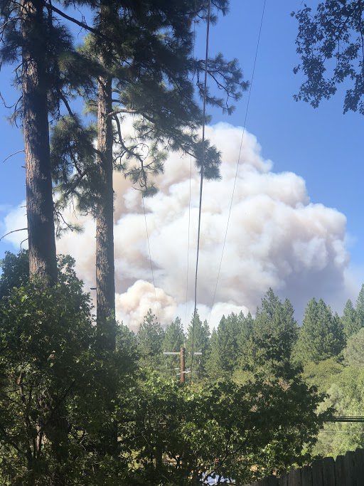
River Fire: Haileyaunna Blackmun
In Hawai’i, a brush fire has burned over 40,000 acres, the largest ever blaze recorded on the Big Island Cyrus Johnasen, a spokesperson for the Hawai’i County mayor’s office, told The Washington Post. Although the fire was approximately 75-percent contained as of Tuesday, August 3, Johnasen cautioned “after effects” within the next two or three months, when heavy rains could create mudslides. “All the areas that have burned, the soil no longer has roots to hold it in place…so that 40,000 acres of burned soil could translate to mudslides anywhere along the west side of the island, resulting in potential road closure or hazardous conditions,” Johnasen said.
Conditions were exacerbated by drought across the state. According to the US Drought Monitor, almost 60-percent of Hawai’i is undergoing at least moderate drought, while the majority of the Big Island is experiencing abnormally dry weather.
In Oregon, firefighters have made considerable progress containing the Bootleg Fire, which has burned over 400,000 acres as of Thursday, August 5. As of Tuesday morning, August 3, the National Wildfire Coordinating Group (NWCG) reported the blaze was 84-percent contained, but The New York Times reported that the fire is not expected to be fully contained until October. Fire officials told reporters that, although cloudy and rainy weather has helped with containment, the forecast in the Klamath Falls area could exacerbate the fire. As of Wednesday, August 4, the location had experienced temperatures in the mid-90s, with wind gusts of up to 20 miles per hour (mph).
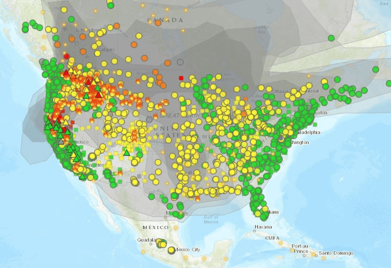 Fire and Smoke Index: AirNow.gov
The wildfires, predominantly impacting the upper northwest of the continental US and Hawaii, have a national and global impact on pollution and air quality; Air Now’s collated smoke advisories detail smoke advisory alerts in Alaska, California, Montana, South Carolina, and Washington State, among others. For example, according to The New York Times, summer camps in eastern Washington State had to shut down this week after a prolonged stretch of unhealthy haze; while officials in Montana issued air quality warnings for nearly the entire state.
To view active wildfire events and the impact they have on national particle pollution and your community, consider using the Fire and Smoke Index and interactive map. Additionally, the National Oceanic and Atmospheric Administration (NOAA) National Air Quality Forecast Capability (NAQFC) and Surface Smoke map tool display current smoke coverage created by large wildfires, especially as their smoke travels across the country.
The smoke across the US highlights the interconnected nature of Earth’s ecosystems and weather patterns. While a wildfire may not be burning in New York City, National Weather Service (NWS) New York reported that residents felt the impacts in late July when they witnessed haze blanketing the city as fires in the West intensified. As noted in the National Aeronautics and Space Administration (NASA) Global Climate Change feature, “A Drier Future Sets the Stage for More Wildfires,” communities are interconnected across the world and will be impacted by intensification of weather and fire events as a result of climate change.
Earlier this year, Hagerty reported that NOAA estimated over 40-percent of the US was experiencing some form of drought. Since then, the US has seen heat waves and excessive heat warnings, including warnings issued today, August 5, in northern Arizona, across southern California, and near Las Vegas, Nevada. According to NOAA’s National Integrated Drought Information System (NIDIS), the heat, combined with existing drought conditions, are forecasted to continue and increase, leading to a greater need for resilience planning, mitigation control, and evacuation preparedness in case of immediate emergency created by fire or unsafe air conditions.
Current evacuation orders show the need for increased planning and support for emergency infrastructure; as of noon on August 5, the California Sheriff’s Office called for expanded emergency evacuations, adding to 2,400 people in Placer County and 4,200 residents already under order in neighboring counties in Nevada. With predicted increased incidence and strength of future wildfire events, evacuations will likely also continue as emergency personnel work to keep the public safe. Residents living in wildfire-prone areas should continue to follow advice from emergency officials and be prepared to evacuate as needed. Information provided below can assist residents in better preparing for emergency situations caused by wildfire and other major weather events.
Earlier today, amidst this ongoing extreme weather, the Federal Emergency Management Agency (FEMA) announced the authorization of $3.46 billion in hazard mitigation funding for the 59 major disaster declarations associated with the COVID-19 pandemic. The increasing duration, intensity, and severity of disasters is only exacerbated by changes in population, land use, and weather patterns as our climate continues to change. This historic level of investment marks a significant shift in federal policy, with the expressed goal of strengthening state and local approaches to community resilience as quickly as possible.

Planning an evacuation route in case of wildfire: Ready.gov
FEMA encourages individuals to prepare and plan for wildfires. As these events can develop rapidly, it is never too soon to prepare for a potential fire incident. Individuals should follow the guidance of state and local authorities. To get a breakdown by state and county of public advisories, NOAA’s NWS has provided a list of red flag warnings and air quality alerts in decreasing order of severity.
The Hagerty Blog Team will continue providing information and updates on current events and disasters impacting the nation. Visit Disaster Discourse for the latest information.
- Remember, Ready.gov provides information on how to prepare for wildfires and how to keep you and your family safe, including evacuation planning, preparing a go-bag, and staying up-to-date on warnings and notices.
- The FEMA America’s PrepareAthon: How to Prepare for a Wildfire.
- The Los Angeles Times regularly updates its tracking of California’s wildfires: California Wildfires Map.
- The National Fire Protection Association (NFPA) provides wildfire preparedness tips.
- Marin County provides a wildfire evacuation checklist.
- FEMA provides an informational video about how to be prepared for wildfires.
Keep track of Hagerty’s incident coverage here:
WILDFIRES 2021