MONDAY, SEPTEMBER 19, 2022 AS OF 11:30 AM EST
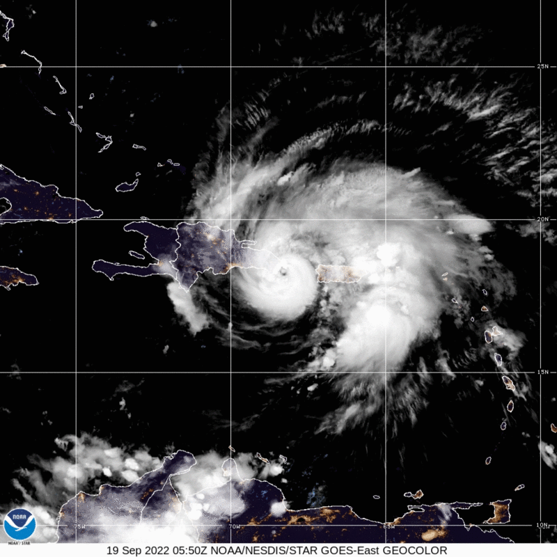
According to the National Oceanic and Atmospheric Administration (NOAA) National Hurricane Center (NHC), Hurricane Fiona, a Category (Cat) 1 hurricane, has made landfall in the Dominican Republic and is moving northwest at 8 miles per hour (mph), with maximum sustained winds of 90 mph, as of 8:00 a.m. Atlantic Standard Time (AST). Currently the storm is located over Samana, Dominican Republic and hurricane force winds reach outward up to 30 miles from the center of the storm.
The NHC has noted Fiona is projected to strengthen over the next two days and possibly become a major hurricane by Wednesday of this week. On Sunday, September 18, Hurricane Fiona brought heavy rain, flash and urban flooding, and high winds to Puerto Rico where it made landfall near Punta Tocon on the southwestern coast at 3:20 p.m. AST. Consequently, the storm knocked out Puerto Rico’s power grid. According to Poweroutage.us, over 1.3 million customers do not have power. On Sunday morning, President Biden approved an emergency declaration for Puerto Rico, giving Federal assistance to the ongoing response efforts of the Commonwealth.
 Hurricane Fiona – GeoColor: NOAA
The NHC predicts hurricane conditions to continue to spread across portions of the Dominican Republic throughout the day today and into tonight. Eastern areas of the Dominican Republic may experience similar conditions as Puerto Rico, mainly flooding as well as potential mudslides and landslides, with the potential for upwards of 15 inches of rain. According to the NHC, Hurricane Fiona is expected to strengthen after moving away from the Dominican Republic. Hurricane conditions are expected in the Turks and Caicos on Tuesday with the southeastern Bahamas expecting tropical storm conditions later today or early tomorrow, Tuesday, September 20.
Impacts
While Hurricane Fiona remained only a Cat 1 hurricane as it passed over Puerto Rico, the Saffir-Simpson Hurricane Wind Scale, which categorizes hurricanes, only accounts for sustained wind speed and does not consider other impacts like rainfall. In a bulletin published at 2:00 p.m. AST on Sunday, NOAA’s NHC predicted 12 to 16 inches of rain with a maximum of 25 inches, particularly across eastern and southern parts of the island. Due to this rainfall, the NHC also predicted “life-threatening and catastrophic flash and urban flooding, along with mudslides and landslides.”. Hundreds of people have been evacuated across the island; however, all flights out of the Luis Muñoz Marín International Airport in San Juan were canceled as of Sunday morning. A temporary bridge located in a central mountain town called Utuado installed after Hurricane Maria – which impacted Puerto Rico on September 20, 2017 almost exactly 5 years ago – was completely washed away yesterday as it was overwhelmed by rushing river waters.
The entire island of Puerto Rico has been without power since Sunday afternoon after several transmission line outages led to an island-wide power outage. Luma, the private consortium managing the electrical transmission and distribution system in Puerto Rico, confirmed on its website that due to the scope of the outage and the continuing hazardous weather conditions, full restoration may take several days. As of early Monday morning, some power has been restored to San Juan’s medical complex, the island’s primary hospital system. While the center of Hurricane Fiona has moved past Puerto Rico, and is now centered around the eastern part of the Dominican Republic, the outer bands of the storm continue to affect Puerto Rico and the Virgin Islands with heavy rains.
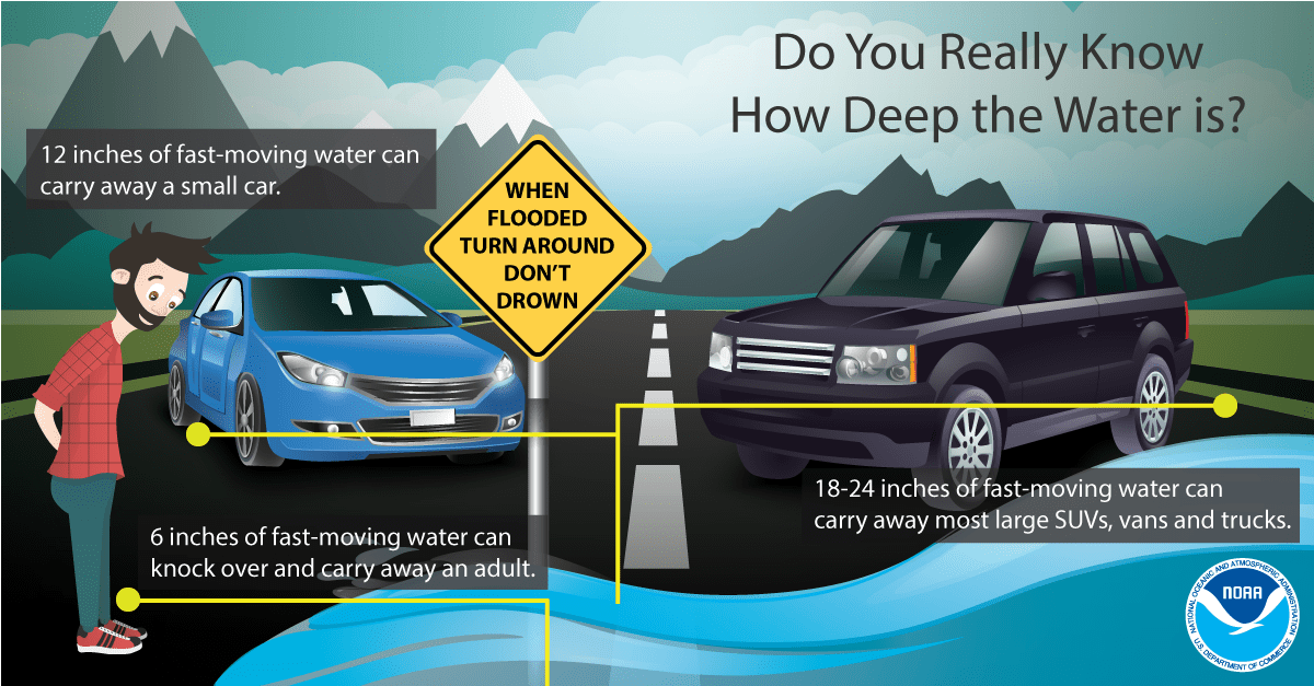
NOAA Guidance Flood Safety: Source
The Federal Emergency Management Agency (FEMA) encourages individuals to take the necessary precautions and prepare for flash flooding. It’s imperative to remember that flash floods can develop with little to no warning, quickly changing the surrounding area. FEMA suggests individuals seek higher ground, avoid walking or driving in flood waters, and heed the warnings of local authorities. Additionally, the National Weather Service (NWS) offers advice and guidance for those about to experience, currently impacted by, or previously affected by tropical storms and hurricanes. Individuals at risk are encouraged to secure their home, remain up-to-date with information from their local NWS office and local government/emergency management office, and follow guidance issued by local officials.
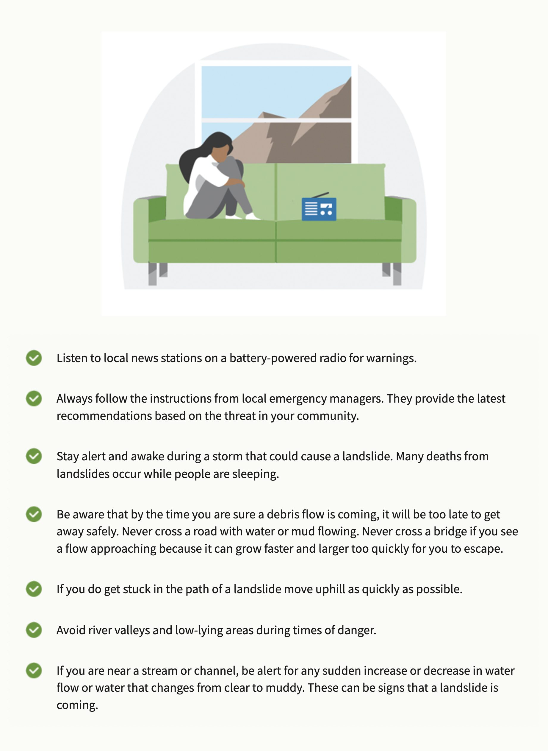
During a Landslide: Source
Ready.gov provides information on how to prepare for, recognize warning signs, react to, and recover from mud and landslides and debris flows. It is important to understand the warning signs of both fast and slow moving landslides.
The Hagerty Blog Team will continue providing information and updates.
RELATED STORIES
STAY UPDATED AND LEARN MORE HERE:
- Remember, Ready.gov provides information on how to prepare for a storm and how to keep you and your family safe.
- Understanding the meaning of hurricane maps – a NY Times Opinion Piece: Those Hurricane Maps Don’t Mean What You Think They Mean