TUESDAY, MAY 17, 2020 AS OF 5:00 PM EST
During the week of May 9, 2022, large portions of the United States (US) experienced severe weather.
WILDFIRES OUT WEST
As of Tuesday May 17, the National Interagency Fire Center (NIFC) reports that there are 11 uncontained large fires that have burned nearly 400,000 acres across the US, with over 4,600 firefighters and other personnel supporting the response efforts. While the US remains at National Wildland Fire Preparedness Level 2, which signifies high to extreme fire danger in several parts of the country, the Southwestern US was elevated to Preparedness Level 4 in late April, the earliest the region has ever entered that level, according to Jake Nuttall of the US Forest Service.
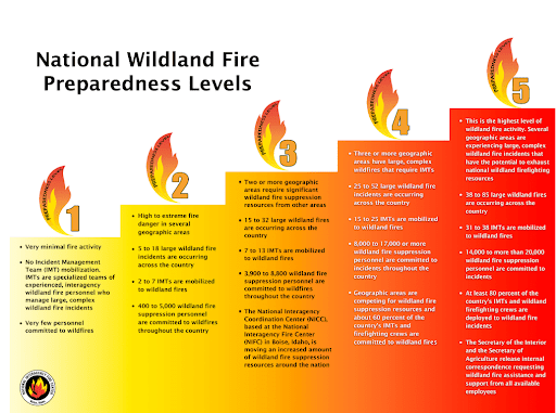
The Southwestern US is currently in Level 4 risk: NIFC
The two most significant fire incidents in the Southwest are located in New Mexico: the Cerro Pelado Fire in Sandoval and the Calf Canyon/Hermits Peak Fire in San Miguel. The Cerro Pelado Fire began on Friday, April 22, by an unknown cause and, as of Tuesday, May 17, spans over 45,000 acres. The Incident Information System (InciWeb) reports that the fire is 71 percent contained and is estimated to be fully contained by Saturday, May 21. According to the Federal Emergency Management Agency (FEMA) National Watch Center’s Daily Operations Briefing on Tuesday, May 17, the fire has led to 733 mandatory evacuations, has destroyed 10 structures, and has caused one injury to-date. Officials continue to closely monitor the fire’s path due to its proximity to the Los Alamos National Laboratory (LANL). However, the laboratory’s website announced on Monday, May 16 that its status will return to the “Ready” stage of Ready, Set, Go in accordance with the Wildland Fire Action Guide published by the International Association of Fire Chiefs (IAFC).
The Calf Canyon Fire and Hermits Peak Fire, which combined to form one complex incident on Saturday, April 23, is now New Mexico’s largest recorded wildfire in modern history and has burned more acres (nearly 300,000 according to InciWeb) across New Mexico than all of last year. Since the fires began (Hermits Peak on Wednesday, April 6 and Calf Canyon on Tuesday, April 19), the FEMA National Watch Center reports over 298,000 acres burned, more than 600 destroyed structures, and 40 injuries as a result of the fires. A Red Flag Warning is in effect today, Tuesday, May 17 from 1:00 pm to 7:00 pm Mountain Daylight Time (MDT) for the eastern plains due to low humidity, strong winds, and high temperatures. According to InciWeb on Tuesday, May 17, containment is currently at 26 percent and a trend of warm and dry conditions is expected to lead to increased fire activity over the coming days.
You all have seen the photos of the smoke plume from Calf Canyon/Hermit’s Peak. Here’s the satellite imagery from this afternoon. Definitely some thick smoke moving southeast. Remember, another Air Quality Alert is in effect tonight. #nmwx #nmfire pic.twitter.com/whpZ1gdX2e
— NWS Albuquerque (@NWSAlbuquerque) May 15, 2022
Twitter: NWS Albuquerque
EXTREME WEATHER ACROSS THE MIDWEST
As fires raged across the Western US, the Great Plains were hit with heavy winds and extreme dust that culminated in tornadoes and widespread damages, according to the Des Moines Register. The National Weather Service (NWS) of Omaha confirmed that events on May 12 qualified as derecho storms — widespread, long-lived wind storms that are associated with a band of rapidly moving showers or thunderstorms. According to the NWS office in Sioux Falls, multiple lines of thunderstorms were observed traveling northeast from Nebraska up through the Dakotas and Minnesota at speeds up to 100 miles per hour.
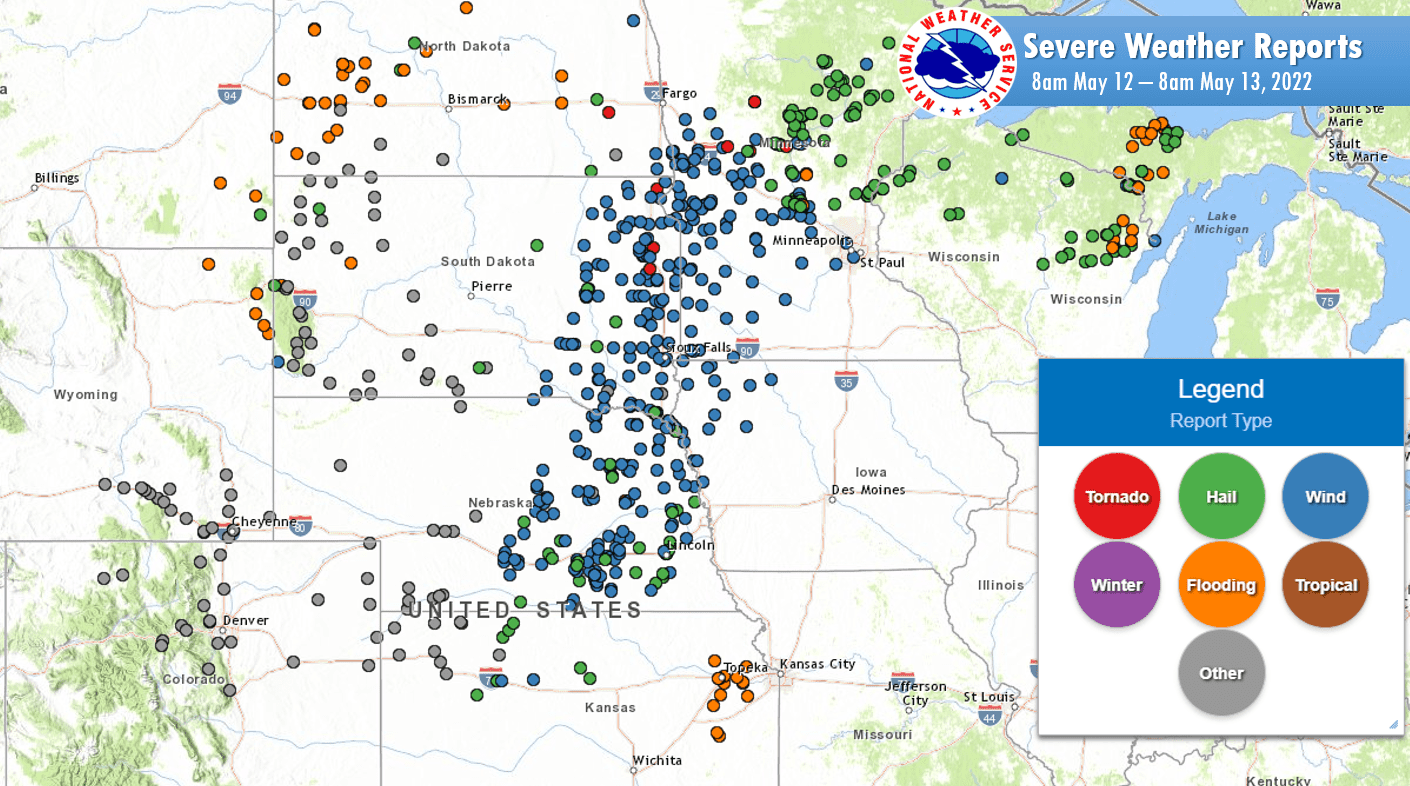
Severe weather reports caused by heavy wind and thunderstorms: NWS Sioux Falls
In addition to thunderstorms, the region experienced a rare weather phenomenon called a haboob, which occurs when wind collects dust ahead of a thunderstorm and creates large clouds of dust across a region. Iowa residents shared photos with the National Oceanic and Atmospheric Administration (NOAA) and NWS depicting the Thursday, May 12 dust storms and showing clouds rolling through farmland and over homes.
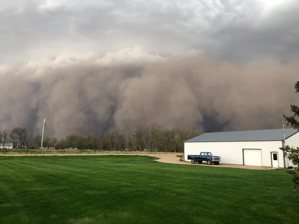
Haboob settling over homes in Rock Rapids, IA: NWS Sioux Falls
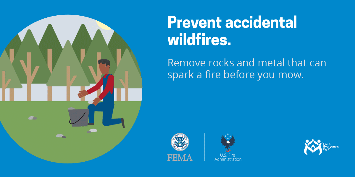
Federal Emergency Management Agency (FEMA): Prevent accidental wildfires
WILDFIRE PREPAREDNESS AND SAFETY
As the frequency and magnitude of wildfire activity continues to rise nationwide, FEMA encourages individuals to heed the guidance of local authorities to remain safe during wildfire events impacting their community. Developing weather situations and conditions are constantly being updated on NIFC’s website. The NIFC’s website also includes current wildfire counts, jurisdictions and states affected, and weather reports. To get a breakdown of public advisories by state and county, NOAA’s NWS provides a list of red flag warnings and air quality alerts in decreasing order of severity.
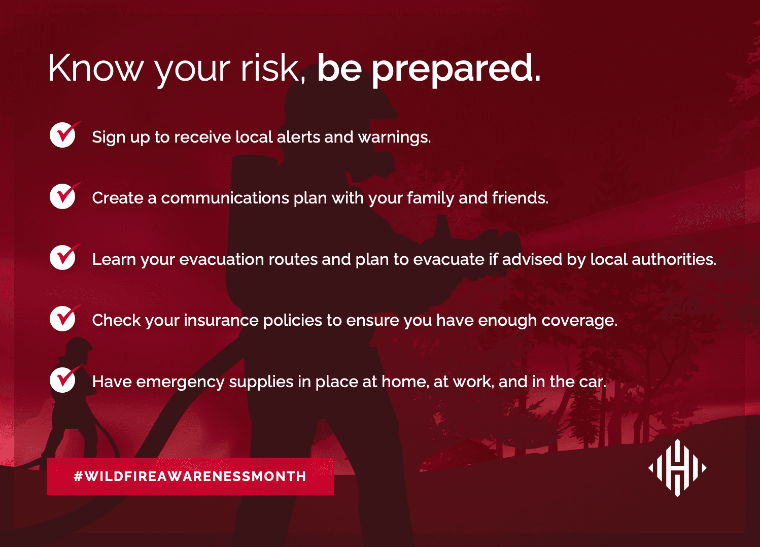
Often, wildfires spread rapidly and without warning, so it is important to know your risk and be prepared. May is National Wildfire Awareness Month, a good time to plan in case one of these dangerous blazes affects your community. Below are several important tips to consider.
SEVERE THUNDERSTORM PREPAREDNESS AND SAFETY
As evidenced by the recent series of severe storms across parts of the Midwest, FEMA warns the public that thunderstorms are highly dangerous and can cause powerful winds, lightning, hail, flash flooding, and tornadoes. FEMA urges individuals to take the necessary precautions to protect themselves against these violent storms. An essential preparedness measure is to sign up in advance for your community’s emergency alerts and warnings and to pay close attention to local weather reports for real-time conditions. Ready.gov provides information on how to prepare for, survive during, and be safe after a thunderstorm.
The Hagerty Blog Team will continue providing information and updates on current events and disasters impacting the nation. Visit Disaster Discourse for the latest information.