MONDAY, SEPTEMBER 14, 2020 AS OF 1:00 PM EDT
Hurricane Sally is approximately 115 miles east-southeast of the mouth of the Mississippi River, with maximum sustained winds of 65 miles per hour (mph), according to the National Oceanic and Atmospheric Administration’s (NOAA) National Hurricane Center (NHC). It is currently moving west-northwest at 8 mph. The center of Sally is projected to move over the north-central part of the Gulf of Mexico on Monday and reach southeastern Louisiana by Monday evening. The NHC said it would make landfall within the hurricane warning area on Tuesday or later Tuesday evening.
For the second time in history, five tropical cyclones have emerged in the Atlantic. Colorado State University meteorologist Philip Klotzbach was quoted in the Orlando Sentinel, describing how seven tropical disturbances (i.e., Hurricane Paulette, Tropical Storm Sally, Tropical Storm Teddy, Tropical Depression Rene, Tropical Depression 21, and two more disturbances) were moving throughout the Atlantic basin on Monday morning.
The Atlantic currently has 4 named storms (e.g., tropical storm+#hurricanes) simultaneously: #Paulette, #Sally, #Teddy and #Vicky. The most recent time that the Atlantic had 4 named storms simultaneously was from September 12-14, 2018 (Florence, Helene, Isaac and Joyce). pic.twitter.com/1jeMG0DlDS
— Philip Klotzbach (@philklotzbach) September 14, 2020
Meteorologist Philip Klotzbach: Twitter
As Sally advances, hurricane conditions are anticipated for Monday evening. A Storm Surge Warning is in effect for Port Fourchon, Louisiana to the Alabama and Florida border; Mobile Bay, Alabama; and Lake Pontchartrain, Lake Maurepas, and Lake Borgne, Louisiana. A Hurricane Warning is in effect for Morgan City, Louisiana to the Alabama/Florida border, as well as Lake Pontchartrain and Lake Maurepas, including metropolitan New Orleans. The NHC also issued a Hurricane Watch for the Mississippi and Alabama border to the Alabama and Florida border. The storm will likely produce flash flooding throughout central and northern Florida, and flooding impacts are anticipated to reach farther across the southeast United States (US) throughout the week. Storm surge could result in 7 to 11 feet of water for the mouth of the Mississippi River to Ocean Springs, Mississippi. Louisiana Governor John Bel Edwards declared a State of Emergency and requested a Federal Declaration of Emergency from President Trump in advance of Sally.
Sally is projected to track further inland early on Wednesday; moving across the southeast US bringing a possible 6 to 12 inches of rainfall to the area. The NHC also cautioned that one or two tornadoes might take place Monday afternoon over coastal areas of the Florida Panhandle, Mississippi, Alabama, and extreme southeastern Louisiana.
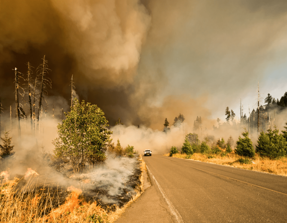
Marcus Kauffman: Unsplash
While many southeastern states begin to prepare for the impacts of Hurricane Sally, residents of 12 western states continue to be affected by the over 100 wildfires. At least 35 people have died — 24 in California, 10 in Oregon, and one in Washington state — from the wildfires over the past couple weeks. Currently, parts of California are experiencing the worst air quality levels they have had in decades. The California Department of Forestry and Fire Protection (CAL FIRE) stated the wildfires in California have burned 3,154,107acres to date, with 4,936 structures damaged or destroyed. Air quality in parts of Oregon has also been deemed hazardous or unhealthy, and is slowing down firefighters ability to fight wildfires across the state. Many towns across Western States have been completely destroyed by fires.
? Prepare your home BEFORE a #Sally arrives:
? Fill your car up with gas.
⛱️ Bring outdoor furniture in and secure items outside.
?️ Place personal papers in a waterproof container on the highest level of your home.
? #HurricanePrep #BePreparedNotScared
— NWS Mobile (@NWSMobile) September 14, 2020
Twitter: NWS Mobile
The NWS encourages individuals to prepare and plan for Sally. It’s never too soon to prepare for an event. Individuals should follow the guidance of local authorities and remain safe.
Having a #GoBag is essential to being evacuation ready. Visit https://t.co/8BZHI0OhNq for a printable version of this checklist and put together your go bag today! pic.twitter.com/dP58ge76Hr
— CAL FIRE (@CAL_FIRE) August 27, 2020
Twitter: CAL FIRE
Additionally, CAL FIRE encourages individuals to continue preparing and planning for the impacts of the ongoing wildfires. With these pervasive fires, hazardous, life-threatening conditions can develop quickly. Individuals should follow the guidance of local authorities and remain safe as many fires remain largely uncontained. CAL FIRE encourages individuals to prepare a Go Bag prior to being under a red flag warning. It is important to be able to mobilize and evacuate quickly. The Hagerty Blog Team will continue providing information and updates on current events and disasters impacting the nation, visit Disaster Discourse for the latest information.
The Hagerty Blog Team will continue providing information and updates on current events and disasters impacting the nation, visit Disaster Discourse for the latest information.
PUBLIC ADVISORIES
Here’s the breakdown of public advisories from NOAA’s NHC:
Tropical Storm Warning
- Gulf of Mexico
To get a breakdown by State and County of public advisories from NOAA’s NWS in decreasing order of severity, click here.
RELATED STORIES
- Remember, Ready.gov provides information on how to prepare for Wildfire and how to keep you and your family safe.
- The Los Angeles Times regularly updated tracking of California Wildfires: California Wildfires Map.
- The National Fire Protection Association provides wildfire preparedness tips: link
- Marin County provides a wildfire evacuation checklist: link
- FEMA provides an information video about how to be prepared for Wildfires: link
- Understanding the meaning of hurricane maps – a NY Times Opinion Piece: Those Hurricane Maps Don’t Mean What You Think They Mean