SUNDAY, AUGUST 22, 2021 AS OF 11:30 AM EDT
Tropical Storm Henri is approximately 40 miles from Montauk Point, New York, moving north-northwest at 16 miles per hour (mph), according to the National Oceanic and Atmospheric Administration’s (NOAA) National Hurricane Center (NHC). The center of the storm is moving closer to eastern Long Island and New England, with the NHC cautioning dangerous storm surge, powerful gusty winds, and flooding is anticipated in parts of the northeastern United States (US).
Tropical storm force winds are reaching outwards of up to 125 miles, with maximum sustained winds close to 70 mph with even higher gusts. Rapid weakening is anticipated after Henri’s expected landfall on Long Island or southern New England late Sunday morning or early Sunday afternoon. After reaching landfall, Henri is forecast to turn back north at even slower forward speed as the tropical storm moves over southern New England.
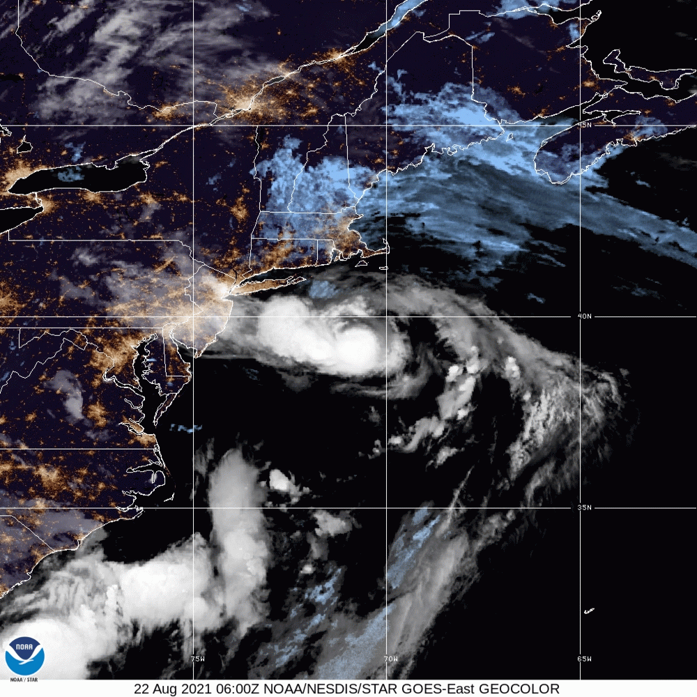
Tropical Storm Henri – GeoColor: NOAA
The Orlando Sentinel reported several gas stations, from Cape Cod to Long Island, sold out of fuel, while Connecticut Governor Ned Lamont cautioned state residents to “shelter in place” from Sunday afternoon to Monday morning.
Tropical Storm Henri approaching the southern New England coast as viewed from the Norton MA (KBOX) radar. At 10 am Sun Henri was 30 mi ESE of Montauk Point NY, or 60 mi S of Providence RI. Henri is moving to the north-northwest at 14 mph with maximum sustained winds of 65 mph. pic.twitter.com/sTiho80LsM
— NWS Eastern Region (@NWSEastern) August 22, 2021
Satellite Path of Tropical Storm Henri on Twitter: The National Weather Service (NWS) Eastern Region
With the coming wind and rain, residents in Tropical Storm Henri’s projected path should take necessary precautions to stay safe. The NWS Eastern Region has a composite list of local forecast offices with recommendations and up-to-date storm warnings for residents to use to stay safe.
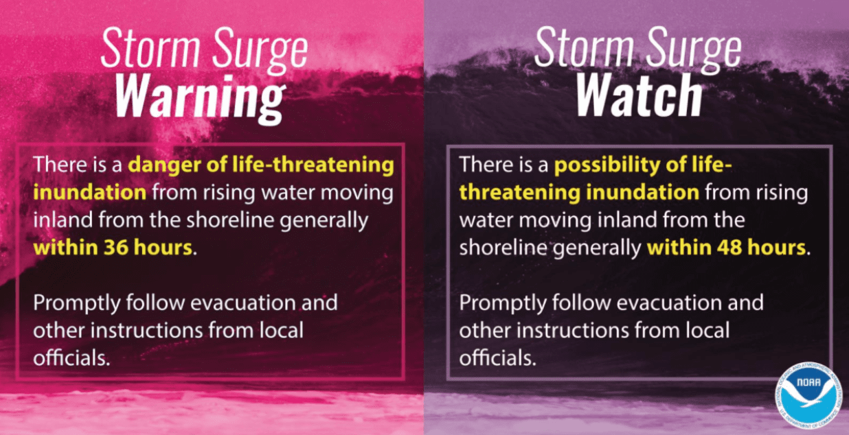
NOAA Guidance on Storm Surge: Source
Tropical Storm Henri brings potential life-threatening storm surge to many coastal communities. NOAA provides information on storm surge warnings and storm surge watches to help individuals be better prepared for potential hazardous situations. The Federal Emergency Management Agency (FEMA) provides guidance to individuals preparing for, experiencing, or affected by hurricanes. Additionally, FEMA encourages individuals to take the necessary precautions and prepare for flash flooding. Flash floods can develop with little to no warning, quickly changing the surrounding area. FEMA suggests individuals seek higher ground, avoid walking or driving in flood waters, and heed the warnings of local authorities. The Hagerty Blog Team will continue to provide information and updates.
RELATED STORIES
STAY UPDATED AND LEARN MORE HERE:
- Remember, Ready.gov provides information on how to prepare for a storm and how to keep you and your family safe.
- Understanding the meaning of hurricane maps – a NY Times Opinion Piece: Those Hurricane Maps Don’t Mean What You Think They Mean

Keep track of Hagerty’s incident coverage here: