TUESDAY, JULY 13, 2021 AS OF 1:30 PM EDT
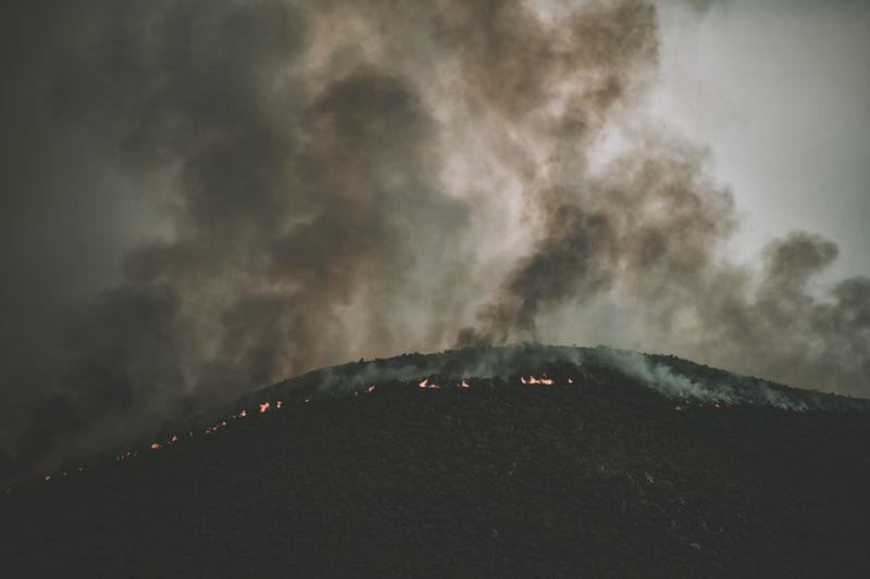
Wildfires continue to spread across 12 states with the National Interagency Fire Center (NFIC) reporting 67 large fires active in the United States (US). 10 new large complex fires broke out in Arizona, California, Idaho, Montana, New Mexico, and Oregon on July 13. In total, these wildfires have currently burned over 917,000 acres of US land. So far, the states of California and Oregon have experienced the greatest impact from fires with over 220,000 acres currently burning in Oregon and 113,000 acres burning in California.
Unsplash: Tim Mossholder
In California, the largest active wildfire is the Sugar Fire which started on July 2. So far, it has burned 92,000 acres and is 30 percent contained. The California Department of Forestry and Fire Protection (CAL FIRE) has noted 142,477 acres and 119 structures have been burned in total across the state. According to the Oregon Office of State Fire Marshal (OSFM), the Bootleg Fire has grown to over 201,000 acres and has forced evacuations in surrounding counties as others are on “get set” and “get ready” watches.
The fires have been exacerbated by continuous record-breaking heat waves across Western US. The National Oceanic and Atmospheric Administration (NOAA) stated, in a report released on July 9, that this past June was the hottest on record. Recent record breaking temperatures at the end of June in Oregon and Washington caused over 190 heat-related deaths.
Since June 1st, we’ve seen at least 67 stations with lengthy reporting periods stretching back at least 75 years that have tied or broken all-time heat records. Many of those occurred with the exceptional Pacific Northwest heat wave in late June. pic.twitter.com/ZjrVprOyeb
— NWS Weather Prediction Center (@NWSWPC) July 12, 2021
Twitter: National Weather Service (NWS) Weather Prediction Center
PREPARING FOR WILDFIRES
As the threat of new and more frequent wildfires continues to rise, the Federal Emergency Management Agency (FEMA) encourages individuals to heed the guidance of local authorities to remain safe during wildfire events impacting their community. There are several ways to recognize warnings and alerts, including downloading the FEMA App and signing up for community alerts in your area. Now is the time to learn and practice your household’s evacuation routes, should local officials order an evacuation notice. The International Association of Fire Chiefs (IAFC) points out that early evacuation provides the greatest chance of survival and also helps keep roads clear for fire and other emergency personnel to access impacted areas. If needing to evacuate during the COVID-19 pandemic, the Centers for Disease Control and Prevention (CDC) recommends first confirming which shelters are open in your area, coordinating sheltering with family and friends, packing personal protective equipment (PPE) and sanitizer, and being prepared to follow the shelter’s public health measures.
To get a breakdown by State and County of public advisories, NOAA’s NWS has provided a list of red flag warnings and air quality alerts in decreasing order of severity.
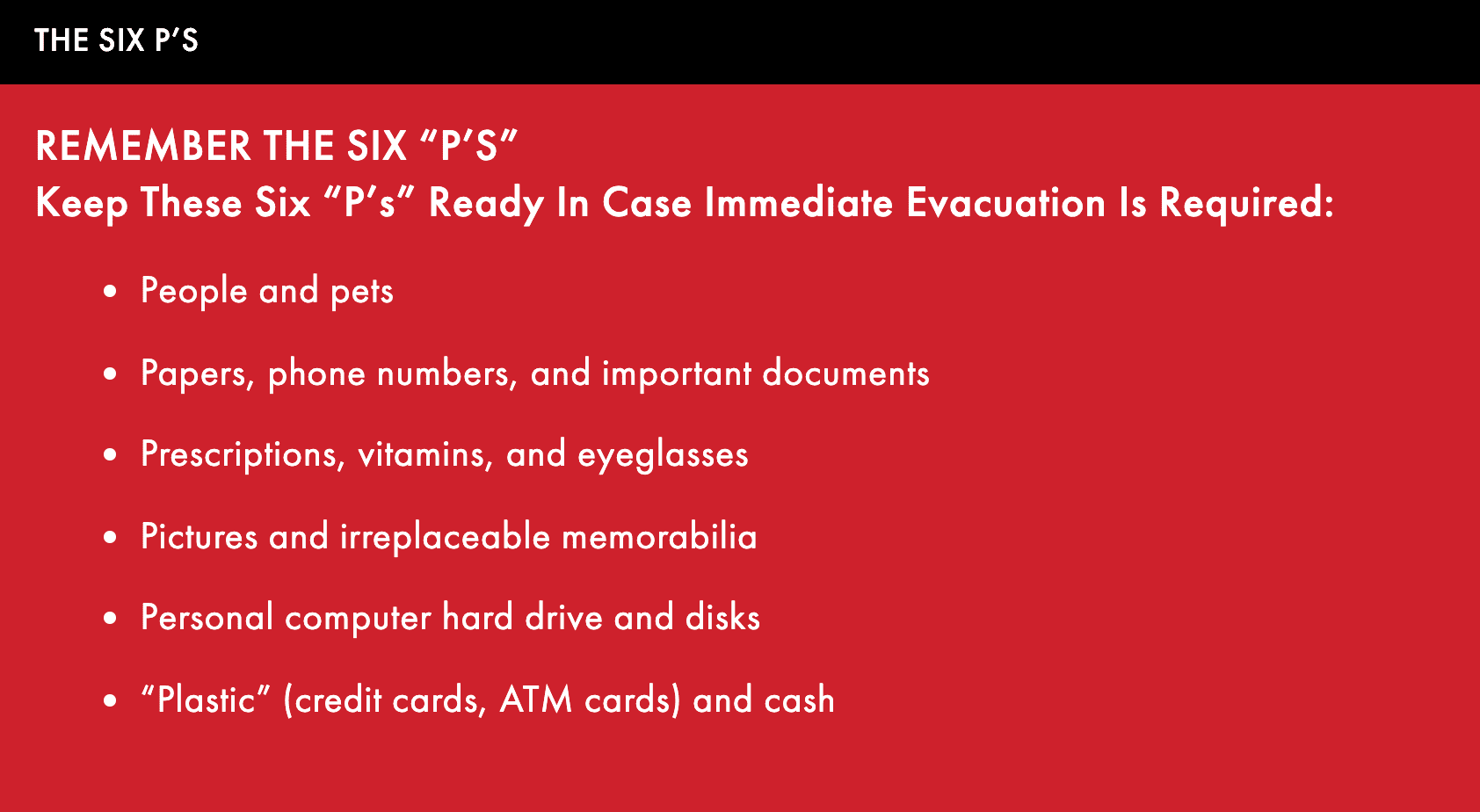 The Six P’s: CAL FIRE
RELATED STORIES
- Remember, Ready.gov provides information on how to prepare for Wildfire and how to keep you and your family safe, including evacuation planning, preparing a go-bag, and staying up-to-date on warnings and notices.
- FEMA America’s PrepareAthon: How to Prepare for a Wildfire.
- The Los Angeles Times regularly updated tracking of California Wildfires: California Wildfires Map.
- The National Fire Protection Association provides wildfire preparedness tips: link.
- Marin County provides a wildfire evacuation checklist: link.
- FEMA provides an information video about how to be prepared for Wildfires: link.

Keep track of Hagerty’s incident coverage here: