Tropical Storm Bertha
According to the National Oceanic and Atmospheric Administration’s (NOAA) National Hurricane Center (NHC), as of 11:00 a.m. Eastern Daylight Time (EDT), a Tropical Storm Warning is in effect for portions of the Gulf Coast ranging from the Florida Panhandle to southeastern Louisiana due to Tropical Storm Bertha. Officials forecast that the system will likely continue to move west-northwest near or along the northern Gulf coast over the next several days.
At 11:00 a.m. EDT, the NHC reported that Tropical Storm Bertha was located in the Gulf, about 70 miles south-southwest of Panama City, Florida, and about 145 miles southeast of Mobile, Alabama. The storm’s maximum sustained winds are near 60 miles per hour (mph) with tropical-storm-force winds extending outward up to 90 miles from its center. The NHC predicts the system will gradually weaken as it travels along the coastline.
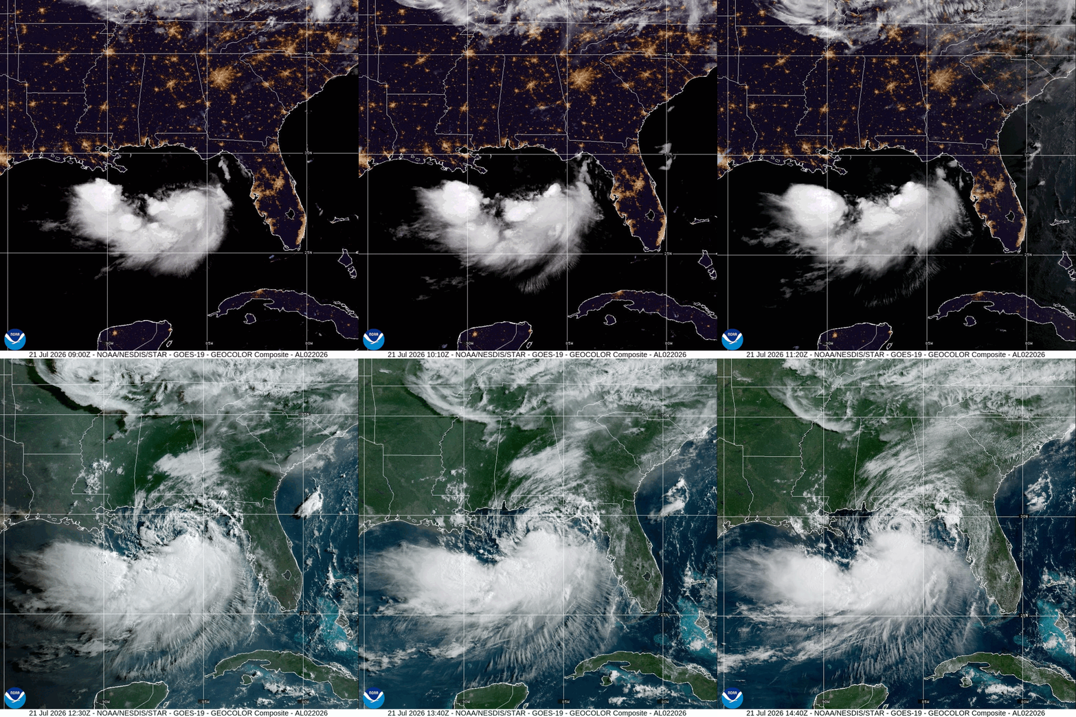
NOAA GeoColor: Tropical Storm Bertha
As of Tuesday, July 21, a Coastal Flood Warning is in effect for coastal communities in southeast Louisiana and Mississippi with water levels potentially reaching up to three feet at the time of high tide. Additionally, areas of isolated flash flooding will be possible through Friday, July 24, along the Gulf Coast from western Florida into southern Louisiana and the Upper Texas coast.
Flooding: Texas Hill Country
Between Sunday, July 12, and Friday, July 17, a slow-moving storm system stalled over South-Central Texas and the Hill Country, producing days of torrential rain across the same region devastated by last July’s fatal floods. Over the course of the storm, precipitation totals in parts of Hill Country exceeded two feet, resulting in catastrophic flooding. As of Monday, July 20, state officials have confirmed at least two flood-related fatalities and reported over 275 water rescues from flooded homes and stranded vehicles in communities near the Guadalupe and Pedernales Rivers. According to the United States (US) Geological Survey, at the height of the deluge on Thursday, July 16, the Guadalupe River rose rapidly, from around five feet to more than 37 feet in roughly three hours.
The flash flooding also significantly impacted transportation infrastructure across numerous Hill Country counties, including Medina and Uvalde. The state reported approximately 77 state-maintained roadways were impacted or closed due to significant road damage and debris on Friday, July 19. In response, Governor Greg Abbott requested a Presidential Disaster Declaration on Friday, July 19, to support the state’s ongoing response and recovery. By Saturday, July 18, President Trump approved federal disaster assistance for 28 impacted counties, authorizing the Federal Emergency Management Agency (FEMA) to support disaster relief efforts.
As of Monday, July 20, the region has shifted from emergency response to cleanup and recovery. Governor Abbott visited impacted communities on Monday, July 20, to brief state leaders on the recovery effort, while officials urge residents in affected counties to maintain caution as some river levels remain elevated.
Thousands of #TeamTexas responders remain activated to support storm and flood response and recovery efforts.
State resources, as well as local responders on state deployment, are critical to our mission.
Continue to track local forecasts & follow directions of local officials. pic.twitter.com/tT7QP5pZHV
— Texas Division of Emergency Management (@TDEM) July 18, 2026
X: Texas Division of Emergency Management (TDEM)
Poor Air Quality Across the Upper Midwest to Northeast
From Thursday, July 16, through Sunday, July 19, areas from the Upper Midwest to Northeast were impacted by dangerous air quality levels. Smoke from wildfires in Canada, the Boundary Waters in Minnesota, and the Pacific Northwest wafted over the parts of Illinois, Michigan, Ohio, and Wisconsin, as well as Maryland, New York, and Pennsylvania, prompting extremely hazardous air quality and hazy conditions. According to the Canadian Wildland Fire Information System (CWFIS), as of Monday, July 20, there are 808 active wildfires across the country that have burned over 6.7 million acres to date. Officials report that wildfire activity across Canada is a result of sustained periods of high temperatures and below average rainfall levels, thereby drying out vegetation which serves as fuel for fires.
The air quality index (AQI) is driven by data which measures air pollution on a scale of zero to 500. A value between zero and 50 is considered to have little or no health risk, while anything above 200 or 300 is considered very unhealthy or hazardous, respectively, increasing the risk of health effects for everyone.
In the suburbs of Chicago, air quality levels were recorded between 800 to 900 on Thursday, July 19—nearly tripling the previous record for the area. Levels in the City of Chicago reached 753, marking the city as having the worst air quality in the world that day and breaking the city’s previous record for poor air quality levels. In Cleveland, Ohio, the city’s director of public health reported the local air quality index reached a record level of over 600 on Thursday, July 16. This nearly doubled the city’s previous record of over 300 set in the summer of 2023. The levels recorded in all of these cities far exceed the hazardous threshold, reaching unprecedented levels.
By Friday, July 17, the National Weather Service (NWS) issued air quality alerts affecting more than 100 million people in 18 states and the District and Columbia, stretching from northeast Minnesota to southeast Virginia.
#AirQualityAlerts are in place over a swath of the U.S. stretching from Minnesota to North Carolina. @NOAA’s #GOESEast (#GOES19) 🛰️ captured this imagery of the source of the alerts—smoke from the Canadian #wildfires, which continue to burn this afternoon. pic.twitter.com/N2LCRjpjiz
— NOAA Satellites (@NOAASatellites) July 17, 2026
X: NOAA Satellites
Wildfires Impact the West
As of Tuesday, July 21, there are currently 74 large active wildfires which have collectively burned 3,960,623 acres across the US, according to the National Interagency Fire Center (NIFC). States experiencing the highest volume of wildfire activity include Oregon with 22 active fires, followed by California, Florida, Idaho, and Minnesota.
The largest of these is the Hay Creek Complex, which encompasses several fires burning in Gilliam and Sherman Counties in Oregon. The fires ignited on Friday, July 17, after a cluster of storm cells passed through the state on Wednesday, July 15. During the storms, the area covered by Central Oregon Fire Management Service (COFMS) and the Oregon Department of Forestry (ODF) received more than 2,000 lightning strikes, igniting dozens of fires across the state’s dry vegetation. The fire complex has since grown to 115,534 acres with a containment percentage of 20 percent as of Tuesday, July 21. Interagency fire crews continue to work hard toward containment on each of these incidents across the state as winds and high temperatures moderated on Sunday, July 19, resulting in a reduction of fire activity.
Know Your Risks, Be Prepared.
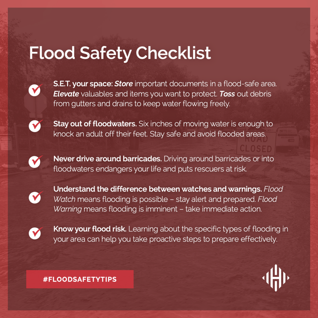
Tropical storms bring potentially life-threatening conditions to many coastal and urban communities. As such, FEMA encourages individuals to heed the warnings of local authorities and take the necessary precautions to prepare for flash flooding and storm surge. Flash floods can develop with little to no warning and quickly change the surrounding area, making it important to understand the risks and have a plan. FEMA recommends individuals seek higher ground, avoid walking or driving in flood waters, and heed the warnings of local authorities during flash flood and tropical storm events.
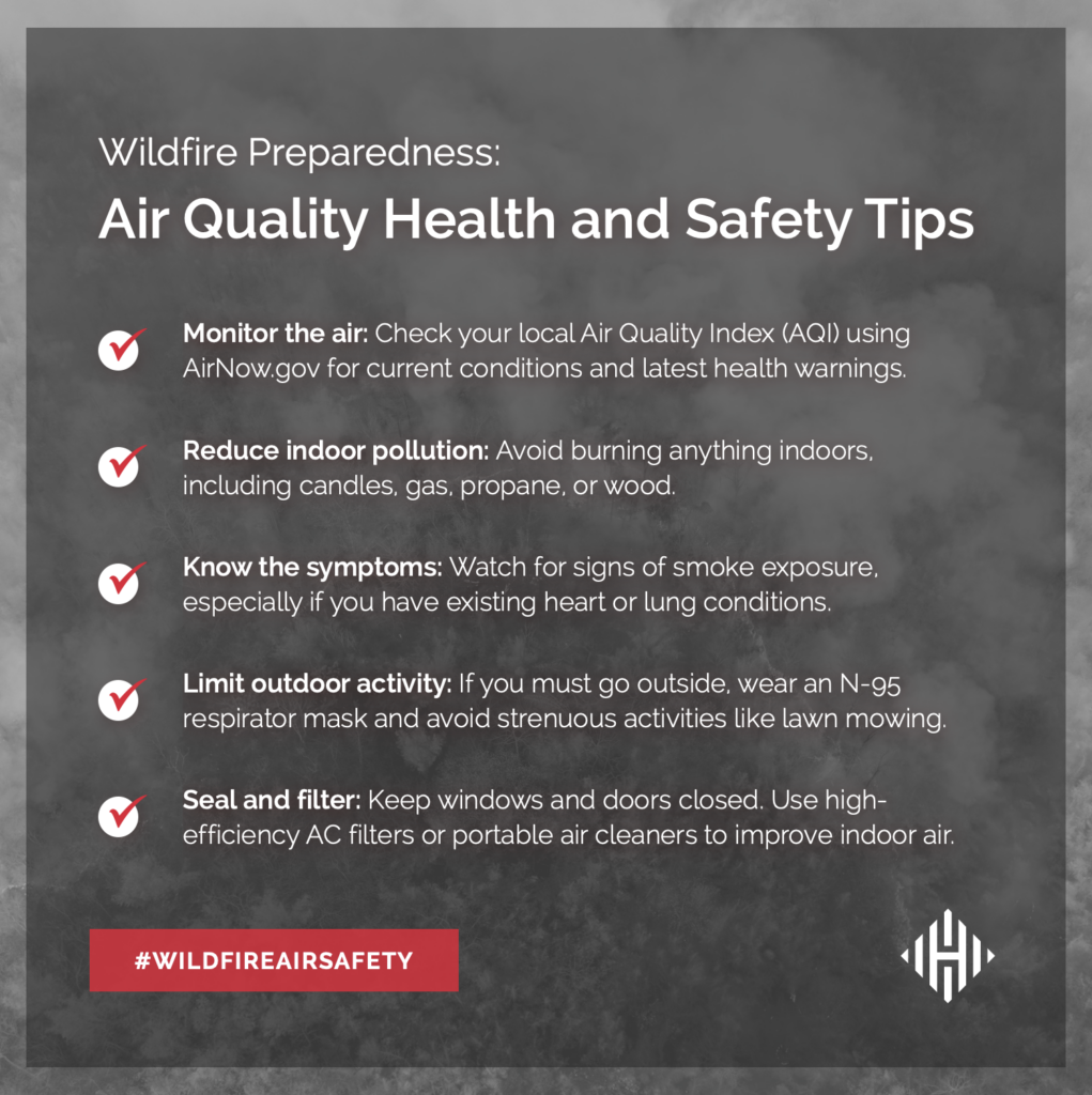
Additionally, FEMA urges individuals to be prepared and take necessary safety measures before and during a wildfire. In the event of a wildfire, it is important to follow evacuation orders immediately and adhere to the additional safety guidance provided by FEMA. According to AirNow, the biggest health risk of wildfire smoke is from fine particles. The Centers for Disease Control and Prevention (CDC) and FEMA suggest the measures outlined below to help protect against wildfire smoke:
Hagerty will continue to provide guidance on making effective preparations for long-term recovery and continuing our situational updates. Consider subscribing to Hagerty’s monthly newsletter for ongoing updates on the Atlantic hurricane season, extreme weather, and wildfire activity nationwide.
Stay Updated and Learn More Here:
- Remember, Ready.gov provides information on how to prepare for a storm and keep you and your household safe.
- Learn more about wildfire warnings and alerts, as well as how to stay safe during a wildfire and when returning home.