According to the National Oceanic and Atmospheric Administration’s (NOAA) National Hurricane Center (NHC), Hurricane Isaias made landfall near Destin, Florida, along the western Florida Panhandle, around 8:30 pm Central Daylight Time (CDT) on Friday, October 9. The day before, Isaias made history when it reached hurricane strength, breaking a 121-year record for the latest date in a year for an Atlantic hurricane to form. On the morning of Friday, October 9, Isaias briefly intensified into a major Category (Cat) 3 hurricane with winds of 120 miles per hour (mph).
At landfall, Isaias was a Cat 2 hurricane with maximum sustained winds of 105 mph. Shortly after landfall, the system downgraded to a tropical depression as it moved north through Alabama, then northeast through Tennessee, Kentucky, and West Virginia. By Sunday, October 11, Isaias had dissipated over West Virginia.
As it moved northeast, Hurricane Isaias brought severe winds and flooding, resulting in at least four fatalities in Alabama and Florida, as well as hundreds of thousands of power outages across the Southeast and central Appalachians.
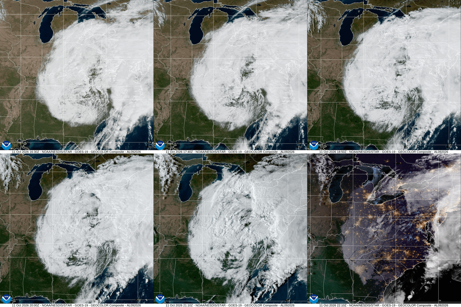
Post-Tropical Cyclone Isaias – GeoColor: NOAA
Before Isaias made landfall, Florida Governor Ron DeSantis, Georgia Governor Brian Kemp, and Alabama Governor Kay Ivey each declared a state of emergency in anticipation of the storm’s impacts. On Friday, October 9, the Federal Emergency Management Agency (FEMA) approved federal emergency declarations for 40 areas across the three states, with 27 in Florida, four in Alabama, and nine in Georgia.
Hurricane Isaias Impacts Across the Southeast
Hurricane Isaias caused widespread damage across parts of the western Florida Panhandle and coastal Alabama, with high winds producing damaging debris that knocked out power for hundreds of thousands. In Milton, Florida, peak winds of 114 mph were reported on Friday, October 9, causing significant power line and structural damage.
Similarly, in Alabama, public works teams worked to clear storm debris in Baldwin and Mobile Counties after strong winds downed trees and power lines across the region. Additionally, Isaias prompted heavy rain in Georgia between Saturday, October 10, and Sunday, October 11. According to officials, the metro Atlanta area received around four inches of rain over 12 hours.
The Carolinas also saw notable rain, wind, and flooding impacts across both states. On Saturday, October 10, several tornadoes associated with Isaias were preliminarily reported across South Carolina, with official damage assessments ongoing. In North Carolina, heavy rain resulted in flash and urban flooding across the western region of the state. On Sunday, October 11, nearly a dozen local weather stations in McDowell County reported torrential rainfall totals, ranging from five to more than nine inches within a 24-hour period. During the inundation, the County’s first responders also reported five landslides across the area.
‼️ Disaster response in action!
@FLSERT & state partners continue responding to the aftermath of Hurricane #Isaias, with approximately 5,000 Florida National Guard Soldiers & Airmen activated to support impacted communities. 🚁
Earlier today, members of @FLGuard rescued occupants from a submerged vehicle, bringing them to safety.
This is Florida’s response in action: saving lives, protecting communities & showing up when it matters most. 🤝
— FL Division of Emergency Management (@FLSERT) October 10, 2026
X: Florida Division of Emergency Management (FDEM)
Power Restoration and Ongoing Hurricane Recovery Efforts
According to the National Weather Service’s (NWS) Weather Prediction Center (WPC), minimal additional rainfall and no further flood impacts are anticipated as of Monday, October 12. Meanwhile, approximately 170,000 customers across Florida and Alabama remain without power as crews, including those from Florida Power & Light, continue restoration efforts. State and federal response and stabilization efforts are also ongoing for impacted water systems and energy utilities across the Southeast.
Hurricane Safety Tips and Disaster Recovery Resources
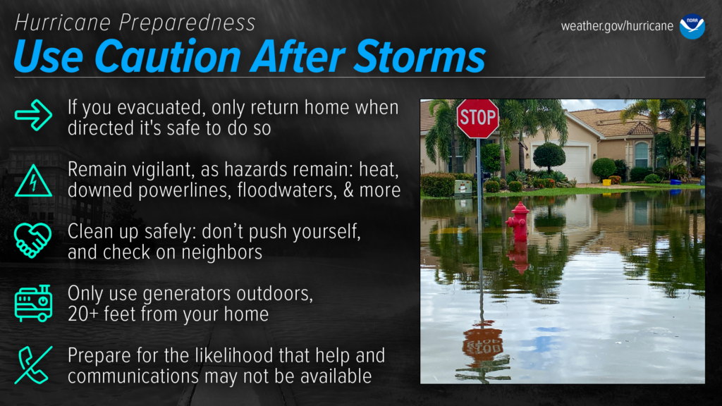
According to FEMA, one of the most important ways to stay safe following a hurricane or typhoon is to pay attention to guidance from local officials and adhere to instructions for returning from an evacuation. When deemed safe to return, the NWS urges individuals to exercise caution walking around damaged property, watching out for loose or downed electrical lines, gas leaks, and failing infrastructure. It is critical to exit the general vicinity if the building smells of gas or if floodwater persists. Post-storm, exposure to carbon monoxide is a serious risk due to the increased portable generator usage following power outages. For more information, the Centers for Disease Control and Prevention (CDC) provides guidance on how to use a generator safely. Additionally, avoid floodwater, as it can hide numerous hazards including sharp objects, downed power lines, and harmful bacteria.
NOAA NWS
FEMA has several publicly available recovery tools to assist impacted individuals and communities following a disaster event. The FEMA App is a personalized disaster resource that can be used to find the closest emergency shelters or FEMA Disaster Recovery Centers. Individuals can access FEMA’s online library of Frequently Asked Questions (FAQs) about Individual Assistance (IA) and other recovery tips; a list of common disaster-related rumors; and information about detecting and reporting disaster fraud. FEMA provides disaster recovery guidance in multiple languages as well as reasonable service accommodations to meet the needs of everyone impacted by a hurricane event.
STAY UPDATED AND LEARN MORE HERE:
- Visit NOAA’s website to learn more about staying safe post-storm.
- Hagerty will continue to provide guidance on making effective preparations for long-term recovery and continue our situational updates. Consider subscribing to Hagerty’s monthly newsletter for ongoing updates on hurricane activity.